Enduro riding is a demanding discipline. Photo wildxplor
I get a call one day from a friend, come riding I have the bikes lets go ride some trails, I was a little apprehensive as my idea of getting out is exploring the mountains on a cheap Chinese 200cc dirt bike, I knew he had something a little more performance orientated.
Martin shows how it is done. Photo wildxplor
I knew Kieron from his diving days, we had dived sea mounts and reefs out at Coiba and he had now decided to start up a small venture running endure tours on the extensive trails and tracks in The west of Panama.
I felt a little apprehensive but turning down an opportunity like this was not an option so on the day I arrived at 8.30am ready to give it a go.
The riders for the day were to be Kieron with seven years of enduro training, Carlos a tour guide from Boquete, for whom this would be his first time off road, Martin whom was a really good Enduro rider with years of experience then myself.
Although I had a few years of riding dirt bikes off and on road, it was never something that I had taken too seriously, The only gear I used for safety was a Helmet and some work boots, I had never raced and tended to go at my own pace. This was to be the first time with all the safety kit.
We got changed in the purpose built change room, by the time the special socks, knee pads, trousers, padded jacket, boots and helmet were on I felt an bit like the Michelin man, though it all looked pretty cool, I have to admit.
We had an informal chat about the tracks we would be riding, with some really good tips to help control the bikes and things to look out for. Then we got the introduction to the bikes themselves, Husqvarna TE250I fuel injected 2019 latest model machines, which were brand new. They are built super light and as I was to find out they are pretty powerful.
Photo wildxplor
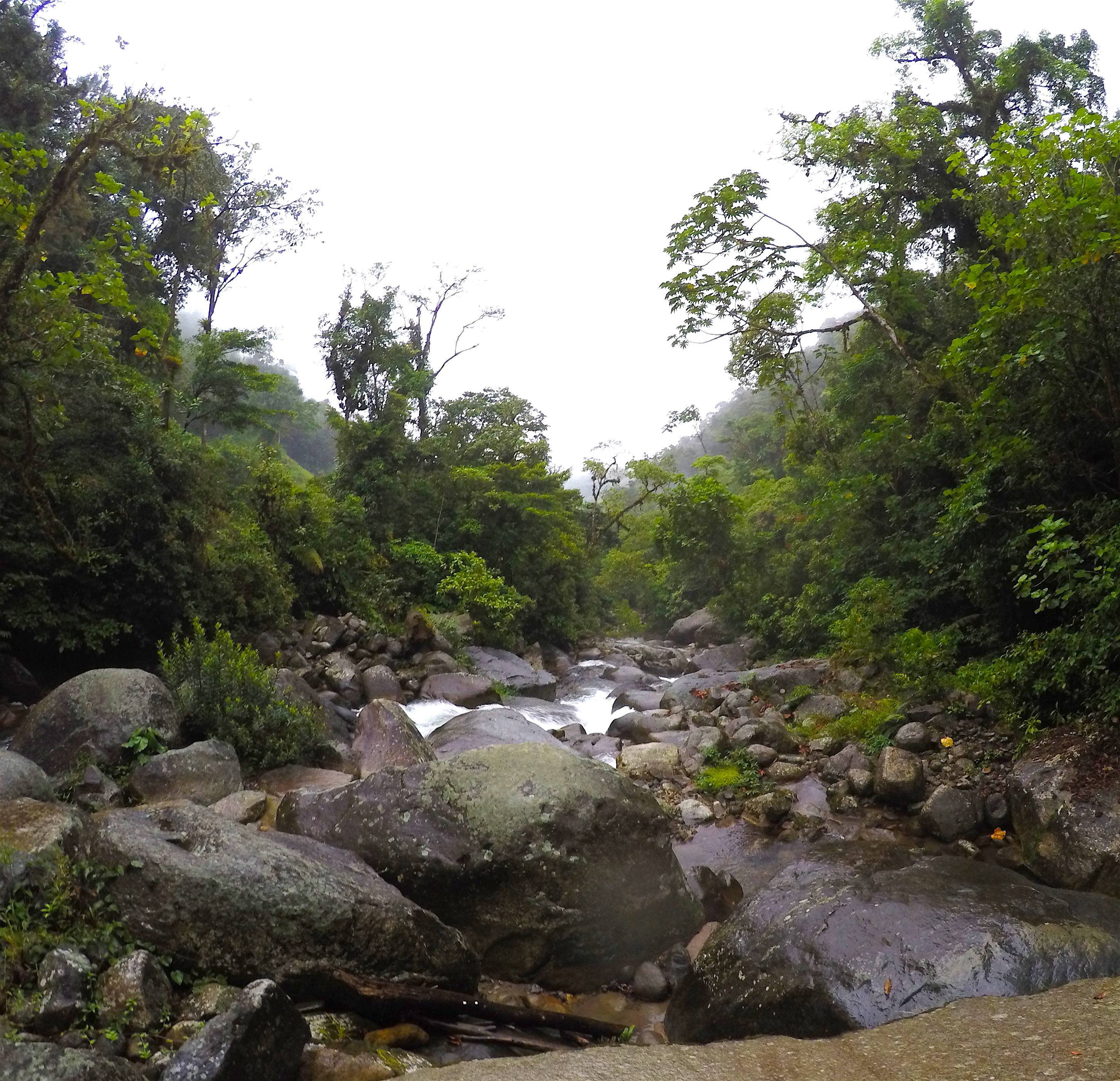
We got going by 9.30am on sealed roads headed for Caldera, the route took us over the mountain at around 1000 meters altitude with some spectacular views, the road giving way to dirt, then we dropped down into the village of Caldera itself.The bikes were fast and responsive, they were also surprisingly easy to ride as long as you did not get crazy with the throttle, Carlos seemed to be doing really well for his first time off road, he was not having too many problems controlling the bike.
Riding to Caldera. Photo wildxplor
With all the safety kit it was warm even at this altitude, getting cold was not going to be a problem, Caldera brought the sealed roads again and we continued up the valley headed to the upper Chiriqui river canyons.
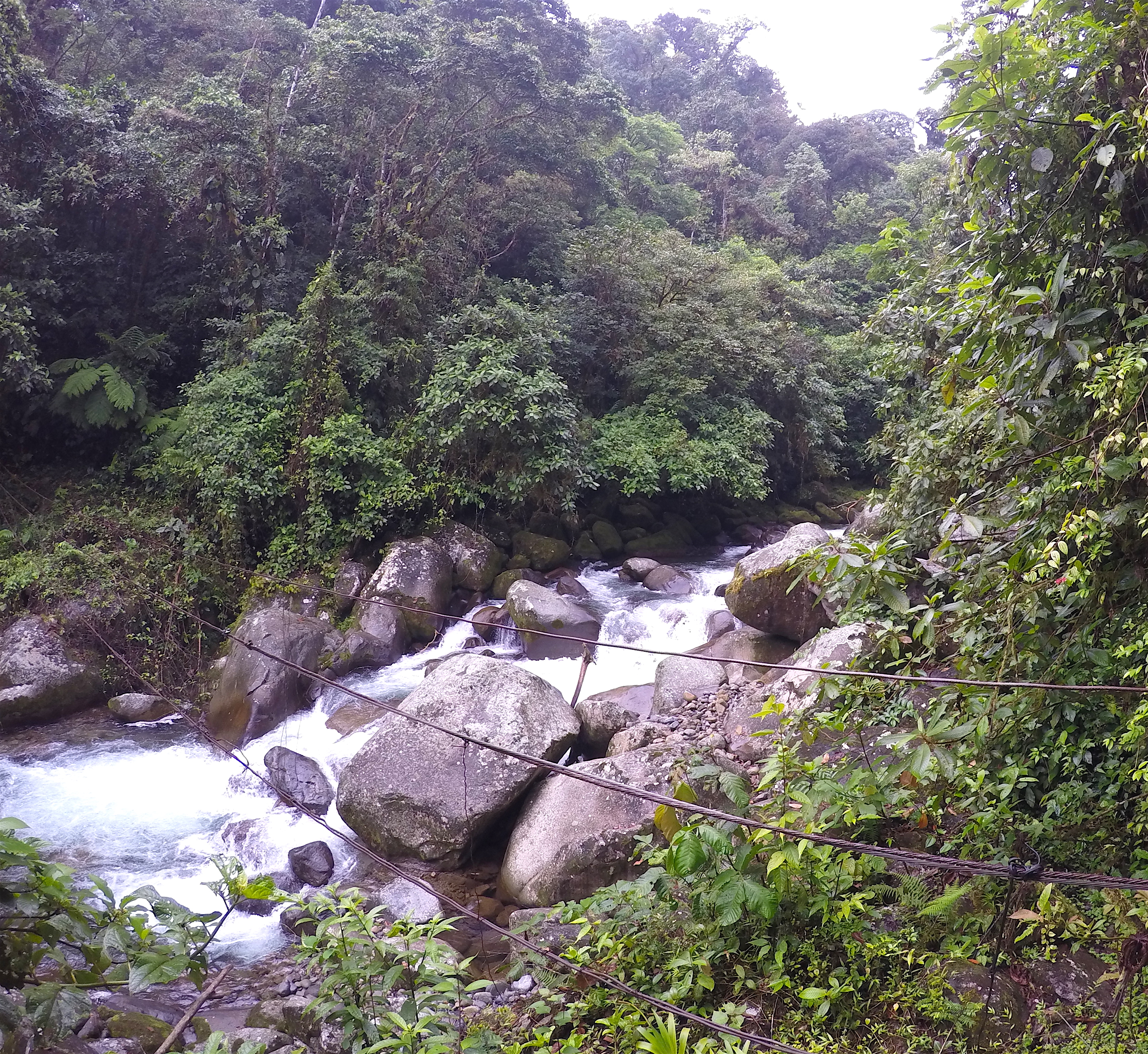
The plan was to follow the valley of the Rio Chiriqui up to the Fortuna dam on one side of the river, then cross the dam to descend a second track back to Caldera. In enduro terms this was a novice trail, but I had ridden it before on my bike and it had its challenges.
We turned off the sealed road at 400 meters altitude and climbed upward on a loose dirt road, the views unfolding before us. Although this area is heavily developed for hydroelectricity it still retains its wild beauty, the mountains ahead of us were the centre of the country, the spine so as to speak, they are still untamed and home to many wild animals. I have seen white faced monkeys, wild dog tracks, Jaguar and Puma footprints and coatis among other animals up here. The river in the canyon itself although controlled by the dams, can still produce world class whitewater kayaking and is home to a fewpaddle blades, paddles and other sundry pieces of gear I have lost playing there.
A Chiriqui suspension bridge
We crossed a long suspension bridge over the Rio Chiriqui, built over a small canyon, before climbing upward to the village of El Silencio,(The Silence) and we were not that silent.
We climbed steadily upwards, for now the climate was still dry the track was steep and rough, we climbed through trees and scrub before breaking out into pastures on the steep mountain sides. The view from this point at 800 meters above sea level was amazing, we could see all the way down into the gulf of Chiriqui some 60 kilometers distant over the lowlands, the surrounding mountains above to the north west are fully forested, the trail was giving us its best face.
The track up to the Fortuna Dam has spectacular views. photo wildxplor
we continued to climb upward, coming to a bit of a lump, I decided it would be good to open it up a bit and get a little jump in, this was the first of two crashes where I underestimated completely the bike. Opening the throttle wide, yes the bike took off alright, problem I was completely out of control. I came down hard on my left hand side, the gear worked well though, I was more worried about the new bike to be honest which turned out to be virtually unscratched. Luckily no real harm was done so we continued on.
Carlos ahead of me had a small run in with the ground, as now the climate had turned wetter and the going more slippery, again the gear did its job and he was unhurt.
We were learning the hard way to respect the machines.
Waterfall in the Mountains. Photo wildxplor
I was glad when we reached the dam itself as I was needing a bit of a break by this time, we were able to eat fruit and some Empanadas which were being sold by locals.
The Fortuna Dam. Photo wildxplor
The temperature was cool up here, the mist was descending sporadicly and it was lightly raining, the lake looked dark with the winds blowing over its waters.
Feeding a goat Photo wildxplor
The Fortuna Dam was built in the early eighties, it was completed in 1984 after ten years of construction, in 1994 it was further raised to a full 98 meters that is its present height, the water drops through tunnels some 5 kilometers to the turbines, and then passes through a further 10 kilometers of tunnel, before re-emerging in the Rio Chiriqui. This colossal engineering project produces up to 30% of Panamas energy needs, and stands at around 1000 meters above sea level.
Crossing the dam and looking down the canyon. Photo wildxplor
Like it or hate it I admit the project has been a great success for the development of the country and is an impressive engineering feat.
We continued across the top of the dam and entered another track which descends the other side of the canyons of the Rio Chiriqui. Now we were descending steeply on the gravel dirt track, it was difficult to keep the bike moving slow enough, first gear, front and rear brake and a lot of skidding proved my lack of experience.
The second of two crashes occurred when I saw a perfect rise on the road to get airborne, again opening the throttle wide, the front wheel rose over my head and I exited off the back seat, unfortunately I had my go pro off and did not get it on video.
The track was overgrown in places. Photo wildxplor
Again the bike was undamaged and myself also but I was learning to respect this machine though.
Climbing a steep section of the trail. Photo wildxplor
Further on the track became less travelled and steeper, it became more challenging to control the bikes on the long descents. Here I managed to lose my Go Pro, having not brought a helmet mount I was putting it in my jacket using the mini tripod, it worked well but finally bounced out on the downhill section, Luckily Martin noticed it and after a half hour of frustrating searching we were able to find it. After passing through a couple of gates we came out at a small river crossing which proved easy enough with the low water levels, this avoided having to cross on the rustic walkway suspension bridge over the deep quebrada (creek). Here there is a small village of only a few houses at the head of the lower valley, which I knew well as the kayak put in of the upper Rio Chiriqui. From here the riding became easier as we made the final descent to the sealed road at 400 meters altitude. We now headed towards home, using a trail that follows the Chiriqui river on its south side and comes out at the hot springs at Caldera. By this stage I was thinking a short soak in those thermal waters would go down well, but the day was getting short. The ride back to Boquete was straightforward passing by a lake at close to sunset, with some Wonderfull views of the province.
We got back to the Panama enduro tours centre before dark after having spent an incredibly eventful day, we covered close to 100 kilometers of roads and trails, most on the dirt.
Although this is probably not for everyone, it helps fill a void for those whom are looking forsomething a bit more adventurous and it allows you to see another side of Panama not so easily accessible but well worth the trouble to explore.
The Summit of Volcan Baru From The Lava Flow. Photo wildxplor
The rio Gariche is one of the few unscathed rivers along with the Gualaca and the Mijgual, which flows from the mountains in the Province of Chiriqui down to the sea without the interruption of any Hydroelectric schemes. Starting in the mountain town of Volcan, right at the base of the Large stratovolcano Called Baru, it plunges off the plateau at 1400 meters down to the ocean, passing under the interamerican highway on the way down.
The Lava Flow To the West of Barus summit Photo wildxplorThe Town of Volcan can be seen in the distance Photo Wildxplor
I had my eye on the upper and middle sect ions for some time, being pretty sure they had never been explored by Kayak before and as the river seemed to pass through a section of Chiriqui which has no real road access and that seemed fairly untouched, at least that is in the river valley itself.
At the put in. Photo wildxplorThe overall layout of the river and descent. Wildxplor
The put in was at a convenient bridge at 1320 meters of altitude, and the first real take out, without the drama of cutting through the forrest was at the next bridge over the river at 260 Meters above sea level.
This latter bridge allows access to the lower section of the river which is a long fun grade 3 down to the take out at the Inter American Highway, halfway between the small town of Concepcion and the Frontier of Costa Rica at Paso Canoas, this being around 100 Meters above sea level, I had run this a few times before and it was always worth the trouble.
So this left the upper and middle section of the river and a drop of 1060 Meters in 32 kilometers, an average of 33M per kilometer.
It had to be done in the hight of the wet season to make sure there was enough flow and as it turned out even then it was fairly low, one had also to time it that the river was not in flood, as I knew little of what to expect once in the Valley and committed.
The whitewater was around grade 4+. Photo wildxplor
From personal observation every river is different as to what kind of rapids and obstacles you may encounter, Gradient plays a big part as well as volume but consider this, a river made up of placid sections which lose gradient over short distances, ie pool drops can be a very different beast than a constantly dropping river with long interlocked rapids. The rock which the waterway cuts through plays a prominent role in the make up of the types of hydraulics encountered, hard granite will be cut with narrow gorges and waterfalls and can make the rapids very powerful, whereas soft volcanic rock can cut very deep gorges with fewer waterfalls and constant white water.
From poring over the air photos of Google Earth it seemed that the upper section from 1320 meters to around 750 meters of altitude had the greatest inclination with the crux being 1100 meters through to 750 meters, there seemed to be quite a few gorges also.
To be honest it looked like at least three days if not four to cover the distance and drop, which meant carrying a lot of gear, apart from the regular kayak stuff there was camp gear, warm clothes, cooking equipment, ropes and climbing gear as well as the usual cameras to record it all.
Photo wildxplor
By the time I had it all together there was over 70 items weighing a total of over 16 kilos, I had shaved it right down, half a toothbrush, half a comb, one pair of shorts and lycra pants with a T shirt, A hammock and flysheet, a small alcohol warmer, 40 meters of rope, harness karibeeners bolts and hammer, drill etcetera. This was going to make the kayak heavy for sure.
So it was during mid October a few days after some heavy rains had swept through the mountains, that I arrived at the put in with all the equipment stashed in the back of the Blazer, having got for up at 4 am to get this thing underway I was able to have everything out on the road by 7-30am at the little road bridge.
The caretaker of the small farm adjacent to the put in kindly allowed me to park the truck inside his field which saved me the problem of taking it back into town some three kilometers distant, it also got me on the creek pretty fast.
The water flow this high up was pretty dismal and the creek itself was hardly six meters wide at the most.
So after packing up the equipment and food in the kayak and promising That I would be back for the truck in three days it was time to launch.
The creek started out uneventfully, and I was quickly to find out that the biggest problem that I Was to encounter, was the large quantities of wood and branches brought down by landslides caused by the recent rains. The creek dropped steeply and the trick was not to get swept into some of these sieves, they were thickly matted and full of bits of garbage, but the current swept through the dense traps with some speed and power, getting out would be unlikely and it would be a sticky end.
This meant I had to stop and scout quite a lot especially if it was particularly steep, or the creek disappeared around a blind bend.
The generally low water flow was therefore a bit of a godsend, and I am not sure It would have been possible with higher flows, as it was I nearly got decapitated by some barbed wire strung across the river, just getting under it in time.
Despite these unforeseen difficulties good time were made dropping 150 meters in altitude fairly quickly, there was some pretty good creeking also, where the rapids were clean it was fast technical and fun.
I have to explain here as it will shed light on the following events, the kayak was an old, that is three seasons old Dagger Mamba 8.1, a great kayak, but now with quite a few repairs, of which I had melted steel mesh into the cracks and then welded them, There was still a very large dented section in the bottom from the previous years bad pin, you get the picture, it was not a picture of health.
So it was no surprise when with the beating it was now taking that a couple of cracks should open up, there was little I could do and so kept going.
This meant that the boat took water, and as the days unfolded it got worse and worse. At this point though it was not too bad and I most certainly was not about to abort the mission for this small detail.
So throughout the day the altimeter in my watch unwound, the kayaking was fast and fun and I was able to stay out of the clutches of the dreaded wood jams, also the garbage was becoming scarcer as I put distance between myself and the town, not too bad.
So in the afternoon around three o clock without much of a break I was starting to think about giving it up for the day, the altitude was about 980 meters and the river was pretty steep at this point. I had guessed the crux would be around the 1100 meters to 700 meter point and it was pretty much working out that way.
The creek dropped through some steep boulders and powerful water directly ahead and after negotiating these I could see that the walls were closing in and the water flow went hard to the left, dropping down a grade four rapid some five meters.
This is the lead into the waterfall, the porterage goes up to the right at the red and yellow bags. Photo wildxplor
I eddied out to the right and looked at this hydraulic, it looked do able and I nearly went for it, but smartly decided to investigate a bit better, I am glad I did, the water squeezed between the small canyon walls and then dropped out of sight.
I was with some difficulty able to climb up the rock wall to the right hand side, and then drop down to the base of the first grade four rapid, it was really slippery and the going was a bit sketchy, but it got me a view of the next section. The creek dropped over a ledge some four meters into a powerful cauldron, and then straight over the lip of a large waterfall, which proved difficult to scout from this point.
The best thing for me was to porter the falls to the right by climbing straight up into the jungle and then try and make my way along and around the cascades, with this in mind I made my way upward leaving all the gear at the rocks on the side of the creek. Very quickly I ran into a wasps nest and got the crap stung out of me, there was no way past it, these small black, almost invisible little sods pack a punch and are pretty territorial, the first you will know of it is the pain they inflict.
Getting round them made the path a bit more difficult but generally luck was with me as I encountered a small jungled terrace above, this lead in the direction I wanted to go. Retracing my path I was able, with a lot of exertion get the kayak and all the gear up to this flattened section then in the direction of the river flow that was right below me, and by the sound of it I had been able to get past the falls, albeit still quite a way above the river now.
This was a great campsite above the thundering Cascade. Photo wildxplor
It had been a good day all in all, the weather had held perfect and I had managed to descend some 420 vertical meters of good boating at class four, So with the way ahead being now blocked by a vertical cliff down which came a thin cascade, I decided to make camp, and quite a spot it was.
The thundering main waterfall was pretty much right below, and by going upward I was able to get good drinking water out of the stream, before it plunged down the cliff ahead of me, the ground was relatively flat and the jungle not too thick.
Howler monkeys could be heard on the opposite side of the canyon, which was much steeper and thickly forested. The whole place had a primordial atmosphere.
After setting up camp and eating a basic meal of Chinese noodles and dried meat I turned in.
Sleeping in a hammock, under a flysheet I passed a wonderful night with the water hammering away below, the moon came up around nine pm bathing the forrest in its silver lighting with the trees casting their dark shadows, Being tired enough to sleep well, certainly helped.
The morning was dry and cool, after a quick breakfast I broke the camp and got everything ready to make the next move, this was basically to let the kayak and myself down about a 33 meter face of mud, trees and loose rock to the the small creek, which joined the main river near the base of the waterfall.
The kayak is prepared to be let down to the river again. Photo wildxplor
Using the climbing gear I had brought along it was easy enough to maneuver the boat down the cliff and then abseil to the base of the waterfall of the tributary creek, the only mishap was dislodging some lose rocks down onto the kayak, luckily no real harm was done.
I was able to jumar back up the rope and then by letting myself back down on a double rope and by using a convenient tree midway down, made it to the bottom in two abseils.
Letting the boat down, it was around 33 meters or 100 feet. Photo wildxplorJumaring. photo wildxplor
Making my way to the main river, I found that the waterfall which had barred my way the day before, poured some twenty meters down into a large pool, which in turn was raised up some five meters above the creek level where I now found myself. Unfortunately it was too difficult to climb up and get a look at the depth of at the base of the falls where the water impacted the pool, this would have been good to know, because although it would certainly be a serious move, I felt as long as the pool had some depth then this could have been run at grade 5+, a grade five lead in to the lip of the fall would mean dropping the grade four rapid and then a boof into the cauldron above, before going over the lip of the falls to pencil into the pool below, one can but dream.
The Falls are pretty spectacular. Photo wildxplor
In saying all this, the five meter falls from the pool above me, dropped into no more than thirty centimeters of water, so no guarantees of sufficient water depth in the pool at all, this is something I have seen before here, twenty meter falls dropping into water at most one meter deep, so nothing can be taken for granted.
Back to reality and the river now seemed to descend without sign of another large cascade, I got the boat down the last of the tributary creek and prepared for a good day on the river.
The feeder creek at the bottom. Photo wildxplor
The altitude now read some 840 meters or so, the whole falls seemed to have dropped some thirty five meters in all and presented a powerful overall picture.
Photo wildxplor
At this point the river had cleaned up and was again in the pristine state which all nature should be found, the garbage was largely now gone from the river and the kayaking although somewhat bony was enjoyable, some of the problems of the excess fallen wood had receded and the only shadow was the sinking boat.
The few cracks in the bottom were joined by friends, so there was a positive party of the damned things, which meant I had to stop every twenty minutes to let the water out, the already overloaded boat would become sluggish and unresponsive not to mention difficult to turn, this would then mean upending it on the bank to open the drain plug and let the water out.
Along with regular scouting of steep sections it was pretty exhausting, but I was making good time nonetheless the altimeter on my watch unwound.
The kayaking was technical, the rapids fast and the scenery outstanding, the rest was just unimportant.
There was some fun kayaking. Photo wildxplor
The weather was now overcast and threatening some rain for later on and I did not want to loose too much time, but the kayak was also taking a lot of water so I decided to stop and at least try and effect a repair, weighing the time this would take against the advantage of reducing the water flowing into the boat.
To do this meant taking everything out and drying it as best I could then sticking duct tape over the cracks, unfortunately getting the thing dry enough to get the tape to stick inside, proved too difficult, so in the end I made do with placing various strips over the cracks on the outer shell and calling it good to go.
Attempting to repair the cracks using duct tape. Photo wildxplor
Well it did get me about half an hour to an hour of respite before the tape was torn off by the rocks of the shallow sections of the riverbed, then it was back to draining the boat at regular intervals.
In fact it was becoming obvious that this was going to be a race between the river, altitude, distance to run and the kayak sinking, which of them was going to win was at this stage was anyones guess.
So with all this in mind when I braced heavily against a rock and heard a pretty audible crack from the paddle it did not help, as the thing is pretty heavily taped to help with the grip, it was not immediately obvious what had occurred, but with the loose action of the righthand blade I was fast coming to the conclusion it had snapped.
When I first got the paddle I had cut off the blade to change the angle from some 45 degrees of feather, to zero degrees feather as that is what I use. Feather being the different angle from one blade to the other, which is used on flat water paddles to reduce windage and has unfortunately, in my opinion stuck around for whitewater kayaking, my view being why complicate things right side to left, they should be equal, which in turn makes reaction faster.
It had snapped where I had re glassed it using carbon fibre tape, luckily I had used a sleeve and it was this that was now saving the day, so to get through I stopped and used electrical tape which was packed for this sort of emergency to re bind the blade, this worked albeit with a little wobble.
It was well into the afternoon, I ate some food and got going just as it started to rain I kept on until a large tributary came into the river from the east which almost doubled the water flow.
This immediately placed me on the map and I had now reached the altitude of around 500 meters and from this point on the kayaking changed with the face of the river, it became a grade three to four affair and was just fantastic, the scenery was pleasant the rain had reduced to almost nothing and it was just plain fun.
The kayak though was now requiring emptying every fifteen minutes and I was becoming exhausted, so at around four pm I found a flat section of riverbank some fifteen feet above the river at a large rapid which was going to be the mornings first challenge.
Unfortunately the waterproof dry bags were not up to being constantly submerged in the back of the leaky boat so all the camping gear was wet, I got the flysheet and hammock up, but the sleeping bag and my spare clothes were sodden.
The second camp beside the river. Photo wildxplor
I changed into them anyway to use body heat to dry them, the rain had also made everything dank, so it was not as comfortable a camp as the previous night, but due to the lower altitude it was not too bad.
I ate pretty well and got some hot chocolate down, for this a small alcohol food serving warmer was used, they are really lightweight and reliable although they do not have the power to actually boil water, but get it warm enough for Chinese noodles and hot drinks.
I carry water sterilization tablets as a clean supply of drinking water is not always available, as was the case here where it was the main river water that I was drinking.
I was pretty cool and stiff in the morning, the previous days exertions were making themselves felt, and the night had been little cold especially towards the early hours of the morning.
There was no chance of fixing any of the cracks on the kayak as everything was too wet and there was little chance of drying anything in the tepid morning sun, so I broke the camp and got going,
Photo wildxplor
the water flow was good and it was straight into the first rapid which pretty much flowed straight into the second, this stretch being pretty a consistent grade three+.
What a great morning. Photo wildxplor
Apart from having to stop more frequently to administer to the sinking boat, it was really great going, the river was beautiful, deep canyons, waterfalls and consistent but fun rapids made the lower mid section of the Gariche to be the jewel of the river.
I pulled the boat out on the bank as the sun was now pretty powerful, which dried it pretty quickly, I had a couple of small tubes of epoxy which were brought as part of the repair kit, along with the duct tape, repairs were made using this and allowed to dry for an hour,The paste seemed to have dried fairly well, though I doubt it could be called completely cured.
I am trying epoxy this time. Photo wildxplor
This lasted almost two hours before the cracks opened up again and then it was back to the draining every ten to fifteen minutes on the the water.
The only consolation was that it looked like I was pretty close to the finish line, another creek came into the river from the west and this placed me at some 320 meters of altitude and figuratively a stone throw from the take out bridge at 260 meters.
I entered a long narrow canyon where there were no serious hydraulics and the kayaking was linked grade three whitewater, just enjoyable
Photo wildxplor
One last serious rapid which ran along a curved and undercut wall at grade four was the final serious challenge, and around the corner there appeared the dark iron suspension bridge, a car noisily traversed its length the steel decking clanking high above me, the paddle clapped on the side of the boat, the water sloshed, I stopped and remained still allowing the kayak to drift with the current, savoring the moment, knowing it would soon pass. The car was the first contact with our overcrowded world in two and a half days, it seemed a profound moment to be honest.
Sublime moment the bridge at the takeout. Photo wildxplor
It was over aside the shouting so as to speak, the boat had remained afloat just long enough to make it, the paddle repair had held, it was a good feeling.
bridge at the beginning of the trail to the Atlantic slopes Photo wildxplor
May of 2016
The plan was to walk the path that is used by the indigenous peoples of the Bocas De Toro province of Panama to transit from the mountain town of Boquete to the Atlantic slopes region of Bocas as it is known. This passes firstly from Bouquete through the National Park of La Amsted or Palo Seco, then the Comarca of the Ngabe, Bugle peoples. The total distance as the crow flies was only some 30 kilometres, it goes over a 1850 meter pass and then through the mountains and forests on the way to Chiriqui Grande on the Atlantic side. The only problem is I am not a crow.
The track has been cut deep into the Forest loam here dropping from the dividing ridge Photo: wildxplor
This Sendero or pathway is still used to bring cattle over from high farms and for the indigenous people to reach Boquete to work or buy supplies and is known as the “Sendero de La Pianista” and I had come to know about it from the search for the two missing Dutch girls whom had gone missing whilst on a day hike some two years before.
At 1500 meters in the cloud on the trail slogging through mud Photo: wildxplor
Starting in the Mountain town of Bouquete early in the morning at 1100 meters altitude it was not a difficult walk up to the restaurant La Pianista, and the start of the trail following the mountain stream upward. It took a further hour and a half to reach the dividing ridge through the low cloud base, which obligingly lifted by the time I made the top. Three local campesinos or farmers arrived at the same time at the ridge top and we talked for a while, they explained that their farm was just over the second quebrada or stream a little lower down some 30 minutes or so and that they farmed cattle, staying some two weeks at a time to work the land. When I explained that the plan was to come out at Punta Robalo on the Bay of Chiriqui Grande, they were surprised and felt it was a long haul, they said I would be passing through tiger territory lower down ( Tigre is the Jaguar) They seemed surprised I would attempt this solo.
Cloud Forrest canopy at 1500 meters Photo: wildxplor
They carried on and I stayed a while to cool down before starting down through the thick temperate Forest to the first stream. From this point the cloud came back in and it was like walking through cotton wool land. The pathway ran through deep ditches which at times towered overhead, It was really muddy, sometimes one sank halfway up your calves, notably it stayed that way until the road was finally reached at the small indiginous town of Nortena, this made me nickname the place ” The land of mud”. I vowed never to wear hiking boots again here, but rubber welly boots that the locals all used (smart people).
Upper tributary of the Changuinola River basin Photo:wildxplor
The second quebrada was just ten minutes beyond the first and is around the same size being really small and generally uninviting. From here the path left the thick forest and passed through cattle pasture in thick mud before plunging once again into densly forested country. There was evidence of animal life everywhere, troops of howler monkeys could be heard and this became common. It was now raining pretty solidly, making the terrain really slippery underfoot.
Dropping down towards the Changuinola river. Photo: wildxplor
Palo Seco national park hut, now abandoned but still a welcome shelter to pass the night. Photo: wildxplor
I had run into an Indigenous bloke walking out to Boquete whom told me there was a hut I could sleep in further on, he had only a machete in hand and nothing else, it was by this time late around 6 pm but he felt he would have no problem getting through by seven, I could not see it myself, He did not seemed worried though and pushed on, tough people these guys. I was tired by now and really looking forward to getting to that hut, This finally appeared after crossing the first river encountered and was located about five hundred yards further on in the middle of a cow pasture. It turned out to be an old National park service instillation, now collapsed and in disrepair. I had to fight some cattle for possession and got the prize of two wooden platforms to sleep on, it was really welcome.
Cooking up some food and tea I was reminded of a simple fact, You can be in the most luxurious hotel in the world and eating the best food that man can find and it would not compare to the simple meal, eaten by a tired wet person coming in from the mountains, its all a case of comparison.
The dark night brought the incredible sound of frogs, they were loud, really loud it was pretty amazing to listen to them, they made you know you were in the jungle. I slept well though, tired from the days exertions.
Wire rope river crossing, simple yet effective. Photo: wildxplor
It was raining by the morning, I got going early and followed the path down the river valley through the towering trees, it descended steeply from 1000 meters at the hut to some 750 meters where it again crossed the same river. A second triple wire rope bridge, crossed this feature, they looked way worse than they really were. The creek was crystal clear and dropping over large boulders and forming deep pools, it looked inviting except for the horse flies that is. They were ever present wherever you were on the trail but were especially bad close to the rivers, making stopping at at times painful.
The Sendero crosses the Rio Culebra here. Photo: wildxplor
The Sendero was now smaller than it had previously been, I was to find out this was due to it being much less used than further up, where the locals use it to reach cattle farms. Further on the people of the comarca tend to go out to the Atlantic side making the central section much less travelled.
After walking some distance more and crossing a marshy pasture with a wooden rough cut board hut, the Rio Culebra was reached and a third wire rope suspension bridge. Here I stripped off and had a swim and wash, fantastic as long as one remained submerged that is.
Got lost and ended up cutting down to the river here to try and find the path. Photo: wildxplor
The path continued on mostly NNW, every time it passed from the jungle and crossed a cattle pasture it became really difficult to follow, as the grass tended not to show the line to follow and of course the cattle had made tracks in all directions. Things went well for about three more pastures but then I lost it completely. Tracing the boundary of the jungle did not show up anything. Finally slogging upward to around 800 meters I ran into a small group of indigenous houses surrounded by gardens of bannana, papaya, yuca and other vegetables. I was able to talk to a really surprised young bloke whom was completely nonplussed at giving directions, the gist of it was “it is too difficult to explain, you just go down and in two minutes you will find the path, its easy”
Ok I went down and it was not easy, I kept going down from 800 meters all the way to the edge of the jungle, then cut down through the very steep forest, after having slashed through a couple of Quebrada’s, down again through the bush until I came out at the River Culebra, without intersecting the path and I now found myself at some 600 meters or so. Ok I was not happy about the outcome and felt maybe I had been led astray, but wisely decided to have lunch, this made me feel much better about it all. So after a while It was slogging back up to the overgrown cleared zone above, through the very inclined jungle, I kept slogging back until almost the small community again, where, and I am proud of this, I resisted the temptation to ask for the directions again. I am sure this reduced the perception that gringos are a little soft in the head amongst the local population. To be honest the only reason I finally found the bloody path again is because I had noticed that a local and his dog had been following the trail earlier on, these were the only legible tracks apart from some really nice big cat footprints which were evident in the mud whilst in the jungle (Cow hooves apart). So tracking back to the last place I knew I was not lost, (a golden rule) and picking up his tracks again which were followed religiously right back and across the huge clearing, then downward to 715 meters where it left the cow pasture and plunged again into the forest.
virgin jungle and cattle pasture Photo: wildxplor
It was now getting later in the day and I was pretty much done in, walking on through the jungle a really fun hollow tree was encountered by the path, if a couple of elves came out to kick me in the shins it would have been fitting.
Home of the little people. Photo: wildxplor
So I was really glad when after following a steep ridge downwards the path came up to a river which was a tributary of the Culebra at 620 meters or so, then after following the bank upriver for about a kilometer another wire rope bridge was encountered (the fourth). This one had an upper wire broken so of course immediately I had to try it out by crossing it, not bad as long as you maintained your weight over the good wire and did not lean back.
The second night camp by the River Photo: wildxplor
There was a really worn sign which marked the edge of the national park so from here onwards it was in the Comarca.
As there was a great soft grass section not too muddy and on a small hill, I decided this was the place to camp, here the tent was set up and the tea brew got going. My legs were cramping along with my shoulders and I was really happy not to be carrying on.
High in the Changuinola River basin Photo: wildxplor
Just about six pm a local, the only bloke I saw on the path that day arrived having carrying a 50lb sack and having just walked from Boquete. He said he had left from his village the previous day made Boquete and was now returning with supplies, and it was a further two hours to get home, (honey I am just going out to get the groceries’ takes on a different meaning here) he asked if I wanted to carry on with him, it would have been good, but I just did not have the energy to be honest and so he moved out, after looking at the broken bridge and decided on fording the river which he managed with a little difficulty.
A broken cable bridge Photo: wildxplor
I slept like a dead man and woke feeling rejuvenated if not a little stiff though, breaking camp early and crossing the broken bridge so as not to get my already wet boots wetter, the path led off steeply upward always from now on in a north westerly direction.
On the comarca of the Gnabe peoples. Photo: wildxplor
The scenery was spectacular , looking down the Changuinola Valley through the patchwork jungle terrain, the path crossed steep pastures and plunged in and out of the jungle.
Photo: wildxplor
I surprised a large coral snake which was just as shocked as me and although it was only about a meter ahead of me it disappeared from the path into what looked like a plant and was not seen again.
Deforestation for cattle farming is a world problem. Photo: wildxplor
The path had been climbing steadily upward and I reached an altitude of some 1000 meters before finally coming on the biggest and practically the only village so far, made mostly of rough wooden sawn boards and dominated by a building with the Panamanian flag flying from a pole. This turned out to be a School, I am sure it is one of the more remote ones in the country. I got to meet the schoolmaster whom told me that he comes for thirty days at a time to teach and that it was six solid hours to get to the road head at Nortena. There were a lot of kids whom were really fascinated to see a Mister (term used all over Latin America by indigenous people to denote a Gringo or I presume anyone they feel they have to say Mister to). I asked the schoolmaster about Jaguars, if they were seen hereabouts and he told me told that they were uncommon and mostly to be found higher up toward Boquete. So there it was, you were safe, when you were higher up they were lower down and when lower down they were higher up – perfect, no chance of being eaten.
A very remote School on the Comarca, it is six hours walk for a fit person to reach a road-head from here. The schoolmaster spends a month on location then a week off Photo: wildxplor
So pushing on from the village the name of which I never got, the path continued through pastures and forest before dropping down steeply to the Rio Romero, where the thickening cloud finally let go and rained in an impressive form, It was not cold so I just carried on and was soon completely drenched, the path turned into a small creek, lightning was coming down within half a mile or so, generally it was just letting me know this was a tropical rainforest zone.
Bridge over the Rio Romero. Photo: wildxplor
The trail passed through several small Gnobe villages of two to three houses all of sawn boards with thatched rooves, the women were all in traditional dress, everything was immaculately clean and there was no garbage to be seen anywhere, in fact that had been the case for the whole walk.
Contemplating the view Photo: wildxplor
For the most part, The Sendero was running along a ridge so the views were breathtaking I was definitely the only odd only thing out in this picture.
Yea its gonna rain Photo: wildxplor
At one point four young girls came up the narrow path all dressed in matching black traditional dress with banded border decoration, we talked for a while, wanting to know why I was there and where I was going. They carried on in single file upwards and I continued trudged down headed towards Cano Sucio the river which led out to the road. It seemed almost a perfect picture with the steep surrounding terrain, Apart from the sounds of the mountains, the wind, rain and the distant creek below nothing more was to be heard, it reminded me much, of places I had seen in the remote mountains of Peru.
Heavens open Photo: wildxplor
The rain let up, I was by now pretty tired as the day had started early and it was now 3pm I had not eaten and was now fantasising about a quiet bench to sit on to eat lunch out of the mud, for some reason I could see it in my head, it would be nice to sit contemplating the view and out of the mud, fat chance.
Socked in: Photo: Wildxplor
Not ten minutes went past, and getting to the top of a small hill on the ridge there in front of me were two small benches of rough wood under a tree, There were no houses nearby and they were the only isolated benches to sit on I had seen up to now and were to see on the whole walk, It was ethereal. In any case lunch of canned spam and crackers was eaten in relative comfort looking out on the wild beauty of the place.
Fractured country, the land of mud. Photo: wildxplor
The path dropped steeply from here and divided, I guessed the right hand one which turned out to be the better of the two although they both would have worked, ahead a toucan flitted from one tree to the next. The wide trail followed another smaller ridge before dropping down to a large village of completely traditional houses where most of the men were working thatching the roof of the central roundhouse. I spoke with them and after explaining what I was doing there, asked the way to Nortena, they pointed to the river where the path continued following the watercourse.
As it had just rained the river was running heavily, the trail constantly forded one side to the other, but even with the heavy current it was possible, the rounded rocks though constantly making you stumble. It was now only 100 meters above sea level so it could not be far now, A young schoolgirl in school uniform and plastic sandals came up the path it was obvious she had just forded the river and was headed home, no school bus here I thought.
Gnabe village near the roadbed at Norteno Photo: wildxplor
Finally a large Village was encountered and there was a large suspension bridge and even a couple small tiendas or stores, people seemed pretty friendly and just assumed I had come in from the main road which was by now not too far away. The final walk out was uneventful, civilization was confirmed when I saw the first Coca Cola sign and was glad enough to drink one to be honest. The store I bought it from was an Aladdin’s cave of just about anything you might need to live here, it was kind of magical. This was Nortena finally, I had heard about it from quite a way off. Interestingly I saw no alcohol was for sale as it is was still the Comarca and therefore not allowed, and it was not until I nearly reached the sealed Road and the border of the reservation where a Chinese store had been set up, that the first signs of beer for sale were to be seen.
I finally reached the Changuinola to Chiriqui Grande Highway the only thing there was the bridge over the river and a couple of bus shelters where I put down, with great relief the monkey on my back in the form of a backpack. It was now 7pm it had been a twelve hour day most of it walking, it felt good to finally stop.
A minibus which was going from direct Changuinola to David arrived, it was pretty full but they made room for me and my pack. Funnily people ask me if I feel in danger doing these sort of trips alone, as if they live safe lives, then without thinking get aboard crazy buses which are driven, as if by the late great Ayrton Senna through the mountains. We are an illogical bunch to say the least.
It still amazes me that perspectives can change so quickly, I was now fully returned to the “normal existence” that we call our lives, but I had been allowed to get a quick look at a tough little paradise which we know very little about, it is very secluded and a little middle earth like, I feel we might all be better off getting a glimpse of that other world.
Continuing through the mountains to the Changuinola Road.The track from the village of Boquete
Like many countries of South and Central America Panama shows a metropolitan face, the city itself is large and modern with many high rise apartment blocks, modern roads, restaurants and shopping malls.
The wild Darien and Choco coast where the jungle meets the Pacific ocean for hundreds of kilometers, interrupted only by small sporadic villages. photo wildxplor
Then there is the Canal itself the great shipping route, dividing the isthmus and the Caribbean sea from the Pacific Ocean. The countryside is dotted with small and pleasant towns, linked by good roads and infrastructure. What though is not often seen by the average visitor is the wild interior, a good portion of the landmass is made up of indigenous reserves, the Guayami, Gnabe, the Bugle, the Guna Yala of the San Blas, The Embera-Wounaan, Talamanca and Teribe. For the most part these people speak different languages than that of Spanish and have lived on the lands for thousands of years, to travel into their territories is to visit another world. Then there are the mountainous regions which get few visitors such as the Darien on the Frontier with Colombia, also the Palo Seco National Park which is shared with Costa Rica. The rivers of the country are little visited unless you can get there by road, most people seeing only the swimming holes close to bridges. Traveling on foot into the interior or making a descent of some of the wild rivers has shown me another world which is not so easy to experience but has been rewarding in many ways.
Taking a break on this Long easy going river through the lowlands. Photo wildxplor.
here is a great whitewater and exploration film made in the uplands of panama. Exploring the upper Rio Chiriqui and the Rio Los Valles. Kayaking at its best.
A trip to London can be a life changing experience, as I was to find out recently, your senses can reach sensory overload when they are bombarded with the constant excitement of the wild attractions of the place.
I am never my best at four thirty in the morning, but I could not see how it could be avoided with all the necessary details this little expedition would require.
I had readied most of the equipment the night before, so loading the car was easy enough, I did some aerobic exercise to warm up and then ate quickly before heading for the door.
Watching the sun come up over the sierras is always something which will never lose its luster for me and this morning was no exception, a lightning storm was playing over the summits which meant it was raining heavily on the Atlantic slope of changuinola, the sky was washed out, the pressure low, here this could mean literally anything to be honest.
I made the small town of Gualaca quickly and started up the Changuinola Road which leads to Bocas de Toro, heading for the 800 meter mark, which would signal the turn off for the pueblo of Londres ( London). The view opened up as the car climbed up the slopes, the richly vegetated ridges and valleys dropped away to the pacific coast behind me.
Pushing downhill to avoid snakes. Photo wildxplor
I turned down the dirt road heading east and was soon in four wheel drive, the clay base had been mixed with stones for traction and apart from the land slipped sections it was not too bad, climbing and dropping steadily to the bulldozer contoured terrain.
The traffic to London was light enough at this hour, as with all hours here, though I had to wait for some cattle to be herded by local vaqueros (cattlemen) into a corral. After some four kilometres or so I arrived at a gate at the top of a ridge, the view was stunning, the whole mountainside was laid out before me, the Cerro Chorcha to the North east, its summit shrouded in cloud, the headwaters of the the Rio Gualaca my destination.
I unloaded the kayak from the roof and packed the equipment I would need into it, the all important overnight bag, in case the river rose or I would not be able to get out today. Like most people I have to be at work Monday morning which makes me a weekend warrior and so I try and plan accordingly. Food a machete ( absolutely essential hereabouts), a rope, a couple of tee shirts, windproof jacket, cameras a neoprene shirt, along with the rest of the kayaking equipment. I have everything ready and note the altitude on the watch 750 meters, Its about two kilometres to the put in and although there is a track, its impassable to all but a battle tank.
I start off by carrying the kayak but luckily there is a field alongside the dirt track and as it is dropping away steeply I can slide the kayak down ahead of me on the wet grasses easily enough,( to avoid snakes) the cattle are not impressed.
Road into the Gualaca River. Photo wildxplor
I had found this spot using google Earth and maps, it is not on the tourist guides, so the locals are not used to seeing people from outside, much less with a kayak, (whatever that is) so when a campesino (farmer) with horse approached a curt “hola” was said and the look of stony disbelief passed his face, and he quickly moved on.
The plan was to put in at the quebrada at Londres the second branch of three creeks (quebrada means creek in Spanish) of which two unified lower down some 750 meters from the crossing point, and the third at a little over a kilometre.
I got to the first quebrada and there was a healthy flow, it had rained the night before, I had gauged this as too steep although the flow is greater than the second and is kayak-able at grade five.
Realizing that using the rope suspension bridge to get the boat across was pushing my luck, I was able too ford with a little difficulty, at this point unfortunately I had to carry the boat another 500 meters to the second creek, the Quebrada Londres, a little lower down at 430 meters altitude.
I met some locals with horses and I explained what I was doing, it was not difficult to read their minds, their conclusion simple enough, he is mad and probably not going to survive the day ( a fairly logical train of events considering ). Their description of the river was, “hay Un gran cantidad de rocas grandes y muy poco Agua“. There are a lot of large rocks and not much water, (not true, there was lots of water and lots of large rocks as I was to find out).
I was covered in sweat by the time I Finally reached the put in.
A second more robust suspension bridge of steel cable had been erected here, the materials for a steel decked bridge lay abandoned all around a common sight here in the mountains.
The creek dropped steeply, the flow was not yet that great, just kayak-able in fact, kitting up in the morning cool, I reflected on the many manifestations of madness and what drives us too do this sort of thing when I could be in a warm and welcome bed with a fuzzy head from having passed a fun night for example.
I did more warm up exercises, no one was around and for that I was grateful, the water was welcomingly cool and restored a little vitality.
There is always that moment for me when the theory ends and reality is staring one in the face, The moment of decision, that defining moment before any undertaking of any worth, a journey of a thousand miles, a worn but absolutely solid Zen proverb. If you bend and go back you will not suffer for it, but you will not know what life can be.
If you jump off it may not go well, there are no guarantees, or you may be able to reach out and grab a small piece of something special and which can never be taken away, like true gold you never know where you are going to find it.
The month is October chosen because it’s the wettest month of the year and a Google maps dry season photo shows the river to be pretty bony, the altitude is now reading 440 meters on my watch.
I start off by running to the right, shortly I am pinned above a meter and a half waterfall, it’s a ridiculous start, a great deal of energy is expended to overbalance the kayak to my favour and after that it all figuratively goes downhill, the kayak slides down a 6 meter rock slide and I come to a stop in the pool below.
Quebrada Londres Photo: wildxplor
I spend a lot of time scouting the steep sections ahead one at a time, clambering down over the slippery worn boulders keeping an eye out for snakes, they are not commonly seen, but it’s a case of if you make the mistake, so it pays to be watchful. Each section is run in matters of seconds and minutes, the creek is dropping at 70 meters per kilometer and all the moves are must make, solid grade 5.
I watch the altitude unwinding on my watch at an impressive rate.
At one point right above a difficult super steep crux section I get the paddle caught in an overhead vine and it takes some contortions to brace out of that one.
The place is delightful, the intertwining forest overhangs the creek, although London is cattle country, it is of rustic fields recently cut, mixed with jungle, just a little higher up the cloud Forest takes over and very little habitation remains, it’s the domain of the Jaguar, Jaguarundi, and Puma, birds abound.
I reach the first union with the western creek branch and the volume more than doubles as it heads into a steep sustained grade 5 section, it is possible to porter some 300 meters through a field to the left and I decide to take the soft option, I feel a little ashamed but the weather is clouding up above and I know it will take a long time to safely get myself through this stretch.
It is turning into a River Photo: wildxplor
Originally I had noted on the map that the whole trip from London down to a second bridge river crossing was some seven kilometres and the river dropped 240 meters, excellent some 35 meters per kilometer, no problem, the reality was the first kilometer drops close to 70 meters and the second more than 50 meters. This tended to spice things up a bit.
I drag the kayak down the field and get back to the river just above where the third quebrada (creek) joins. Taking a break to eat a little guayaba a thick sugary fruit bar that is common here, it gives me instant energy.
A boof over a four foot waterfall and I instantly feel the power of the third quebrada, I catch an eddy left and get out to scout the next section.
From here its solid grade 4+ with little respite, very quick and brutish kayaking, aggressive and forceful with plenty of must make moves, big stoppers and holes abound, each section run is 200 to 300 meters and one rapid is leading directly into the next with hardly a break, fun and terrible at the same time.
I pull out on the right bank above a steep powerful section which curves off around a bend lower down, as there are no eddies I must scout this.
The Forrest is dense but there is a small fishing trail which I follow, the weather is thickening up and its 11am, here one needs to be ready to be off the rivers as early as 1pm as the afternoon rains come quickly and with force.
The section proves run-able though grade 4+ with this volume, its long and powerful with no exit.
I choose a line mostly to the right crossing left for a powerful hydraulic on the right hand side, I get caught in a big hole in the middle of the river. I surf and surf, it’s not letting me out that easily, so I surf brace and catch a forward stroke repeating the procedure moving forward to the edge of the hole, I overbalance upriver and come out laying flat on the surface and managing to sweep upright in time to charge down the next section, finally managing to eddy out on the right hand side.
The adrenaline is now coursing and I am literally shaking, must rest up a while, laying down to control the breathing. This river is giving and giving, it’s a wild thing.
This drop is the entrance to the canyon section. Photo wildxplor
The first raindrops fall and I can see its already raining further up the mountain so time to move, another steep section and I start to run on sight at grade 4 and 4+, things are happening quick enough now I stop only to adjust a camera or drink and eat something.
The kayaking is fast and furious and I am in the zone now, it is all flowing together, I feel fantastic I know I am going to make each rapid as I enter it and this is the moment to live for.
I get spun around and enter a small waterfall backwards, getting stuck in a stopper in mid rapid, close to the bank but miles from it, I see a handhold on a rock and am able to pull myself out backwards to finish the whole thing looking upstream.
The river drops to grade 3 and I see its at 230 meters altitude now, I’ve dropped more than 200 meters in less than 4 kilometers. Some large conduit piping appears on the banks to the left signaling that I have intersected a track lower down, I think it is all over though the water level has risen with the rain.
I negotiate a bend and ahead the river squeezes down through a small canyon. Pulling out to the left I see that it’s a waterfall.
Scouting this proves difficult and I climb up the bank 30 meters to the left to get a look at the base for the essential check for rocks, the rain is hammering down now, I know its over, the river is visibly rising to flood levels.
I call it quits Knowing there will be a second round to finish this fills me with joy.
Now came the slog of hauling the kayak straight up 150 or more meters to the track, getting out of the canyon uses all my strength and I decide to leave the kayak there at the tree line and return for the car. The rain is coming down hard and the river is roaring now, Taking the gear bags I slog up through a super steep field to the mud track, I am returning to earth now and start the long walk out to the changuinola road, with little chance of a lift as this is a hardly passable low ratio 4 wheel drive affair.
I start to walk trudging through red slimy mud, the cloud is low and the valley is in view up to my start point the pueblo of Londres, as always when in the mountains I am happy just to be there, the view is not tame and the volcanic mountain scenery is sculpted by the extreme forces of nature.
For me the greatest attraction of kayaking lies in the unfettered beauty of the environment, often in its wildest and most pristine state, and I tend to gravitate to the rivers with little habitation, for this reason.
Its about four kilometres or more to the changuinola road, past some cattle farms and crossing the River Gualaca via a steel cabled suspension bridge with a suspect wooden deck, the river now much swollen with the rain. The last two kilometers are steeply uphill, I am truly tired my back starting to seize up from the constant bracing. The rain is coming down hard again, there seems little point in changing into dry things and as I get to the road a small minivan bus stops obligingly for me as if on Q, They are not to phased that I’m saturated and for a couple of dollars they transported me to the London Road.
Four more kilometers trudging in the rain and I make gratefully the car, change into welcome dry clothes and get started back to pick up the kayak.
On the way out I give a lift to two teenagers, they tell me that although they live in the town of Gualaca lower down and attend school there, they often spend the weekend with family in Londres as they like the cooler air, and lifestyle in general, and that most of the locals spend their spare time during the wet season fishing in the rivers for a fish they call the Sabaleta which are common, up to three pounds in weigh and silver colour, it puts up a great fight in the white water (best bait yellow cheese, cockroaches or crickets).
I drop them off at the entrance to the second track and start an intricate four wheel drive session to retrieve the kayak, crossing the bridge with some trepidation and arriving with some difficulty above the canyon just before dark.
I slog back through the field and man handle the kayak up to the car, I am just about done in and the day is ending, after stowing the last of the gear and lashing the kayak to the roof rack, I drive back down the track in four wheel drive low ratio in the near dark, following the course of the very audible Rio Gualaca some 300 meters below.
It had been a long and memorable day visit to London, but I realised that something special had just occurred.
One spends humdrum hours of drudgery traveling and working to make a living, hours training and practicing, there are many frustrating days when things don’t go right, broken equipment, the rivers are low and don’t live up to expectations or you just cannot get away, but on this day it had all come together, it would have been hard to have been more perfect, I had struck that gold so elusive and I realised that it had made it all worthwhile.
Boulder whitwater. Photo wildxplor
The Rio Gualaca and its tributaries are one of the last intact wild rivers of the Chiriquí Province of Panama, it borders the Comarca of of the ngabe and Bugle indigenous people and as yet has not gone under the hammer of the low head dam and tunnel, it is an area of outstanding natural beauty, with its headwaters in the mountains of the Cerro Chorcha and Cerro Hornito.
The pueblo of Londres is situated between three feeder creeks of the river.
The old Chevy negotiating the suspension bridge. Photo wildxplor
TURQUOISE GOLD The old Chevrolet Blazer was slipping on the clay and round river rock strewn track wet from the nights rains, up ahead of me was a farmer in his 4 wheel drive, crikey we had traffic jams out here, I had to crawl along behind him until he kindly let me pass, just before the swaying suspension bridge. From there in low ratio I was able crawl and grind up and down the last of the road to a small tributary, which with a bit of luck I would be able to descend into the Rio Gualaca it would come out just above the canyon that had put an end to the descent from London. The morning was clear with mist over the mountain tops, the sun was out and illuminating the green hills and ridges. The creeks water level looked low compared to the descent of a couple of weeks ago from London, but of course this was not yet the main river.
Driving in on the dirt road to the canyon section of the Gualaca River. Photo wildxplor
It was now 8am and it had been another 5am start to get here, it’s amazing how we humans can manage to separate work from pleasure. The only sounds were of myself dragging the kayak out of the back of the truck, kitting up and the low roar of the creek.
I had come across only the one car and a couple of local campesinos on horseback up to this point, I carefully arranged the equipment inside the kayak, the slamming of the doors of the vehicle, dragging the boat down to the rocky riverbank at the creeks fording place, this was all that broke the peace.
The water runs emerald green through this section. Photo wildxplor
At exactly the time all was ready to push off there arrived three local campesinos on horses, the last of which was an old man, they did not seem to know what to make of me, yellow helmet with camera and visor, lifejacket, forearm protectors black rash guard and sitting in a blue 8ft kayak in ten Centimetre’s of water, honestly I imagine I could have looked a little out of place here in these hills.
The old man told me that he thought this should be something for the dry season, I countered that water flow was required for this to work and that was the sum of the conversation, they sauntered off up the track, it was not hard to read their minds.
Looking into the wild uplands. Photo wildxplor
The creek proved a boney ride, and after only 500 meters It entered the river proper and then things started to happen. The water was at about half of the volume of A fortnight ago, and was running clear with a green and white hue. The sun had not yet reached into the steep sided valley and there was a chill in the atmosphere, I had been coming down with a cold, the gripe, and it had been difficult to get motivated in the morning. My body was shivering in the morning air, though the exercise was starting to have its affect. Sometimes its better to go for it knowing that if you wait until the next day you will probably feel worse. The waterfall at the head of the canyon appeared up ahead, the river dropping away steeply beyond the pool at the base of the falls, I pulled into the left hand bank under thick trees at the point of exit of the previous visit. The shimmering wet rock walls blended into dark green and blackened forest, the sun was having trouble penetrating this dank spot.
The canyon section starts with these small but powerful falls. Photo wildxplor
With some difficulty I was able to swim across quite a bit higher up to make the rocky island in the centre of the river and then to the lip of the cascade, the water split and descended some 3 meters to the left and the right of me, the right side being much less powerful than the left, but it landed close to a large rock making it more technical. I am glad I had terminated the previous descent here because the falls created a powerful hole which at this water volume could be negotiated, but I wondered what it might have been with double the flow of the previous descent. I made my way back across the river bouncing over the stones to regain the bank in the swift current, and climbed into the kayak. I jockeyed for the best line possible in the rapids above, before penciling into the spume at the base of the falls, the whole kayak and myself submerged into a frothy tumbling and bubbling world before resurfacing, the boat became still above me signaling the exit from the powerful hydraulic and I was able to quickly roll the boat upright to find myself in the pool below.
The beauty of the place took my breath away, twin falls split by a nose of black rock between them, the pool was the color of green jade which was surrounded by dark rock walls, tree trunks were blackened and the green moss on the rocks came down to the waterline. It was almost as if I had fallen to another level of the natural world, I could not resist taking a swim across to the other side where a cave beckoned to be explored.
The water descended out of the pool via turbulent rapids, it really was a special place, in fact I was not expecting anything like this, the rivers nature had completely changed it was in canyon lands now.
Photo wildxplor
I climbed back into the kayak and ran a grade 3-4 rapid to leave this spot behind, as quickly as arriving, I departed the canyon and the river opened up a bit for a gentle ride, the sun now warming me, it shimmering on the surface, I did some practice rolls in a pool and just admired the scenery, small waterfalls descended into the main watercourse, mosses covered the tree limbs hanging in fronds like beards, shadows played across the surface and the riverbed could clearly be seen as the kayak passed along above it.
Letting my guard down I was surprised by a quickening of the river which squeezed down and sharply curved left and then hard right over a powerful rapid, the senses were instantly changed, I hardened up and lent forward and down river, running it on sight the paddle blade leading as the kayak dropped 2 meters and I shot out into the placid waters lower down, so much for daydreaming.
Again the river became tranquil my watch was showing 200 meters and It was now all over for sure. Dropping a long gentle rapid the river could be seen to bend off to the right and disappear amongst some large rocks at the base of a cleft between the hillsides, I was entering another canyon, the entrance of which looked pretty complicated, this Rio Gualaca was full of surprises.
I exited to the right and walked down to the rocks choking the river, almost the whole volume squeezed down between a thin slot hardly the width of the Kayak, this set up what could only be described as a nozzle which shot the water out below as from the overflow of a dam. Unable to see what came next caused me to backtrack and swim the river further up, making my way to the choke I was able to climb down some 4 meters to below the nozzle, the sight below made me run cold. Two-thirds of all the water flow shot from the churning water where the nozzle jetted the pool below went directly into two blind siphons (the rocks squeeze down and water can flow through but not a person or boat).
The river is squeezed through huge boulders making a nozzle. Portage on the Gualaca River. Photo: wildxplor
The other third of the flow was the least biased of the current, meaning one would be unlikely to end up in it. The whole thing was totally amazing but lethal, close by I came across the skin of a snake, yeah fitting for sure.
Beyond this second row of teeth was another set of rapids of grade 4 or so, powerful but do able, from there the river ran the canyon through consistent grade 3+ rapids to exit somewhere lower down. Again I was struck by the beauty of the place, the turquoise and jade color of the river mixed with the jungle greens which seemed the hallmark of this part of the descent. Re crossing the river was a lot more nerve wracking knowing it was a one way trip if you were swept down into that shark mouth by the swift current. Portaging the left side of this set of natural defenses was not too difficult, sweat poured as the kayak was alternately carried and dropped down to the head of the lower third set of teeth, and the much tamer grade 4 rapid. A complex set of moves led to a chute and stopper which of course I got stuck in, surfing out backwards the kayak was flipped as I dipped the rail up current by mistake, holding the paddle out deep underwater, the current played on it and dragged me out of the hydraulic and it seemed to sweep me upright automatically and out of the rapid.
A dark gem. Photo wildxplor
The river ran straight down through the canyon, I dropped into a sunlight pool where to the right a 30 meter waterfall cascaded down vertically to join the flow, a large bird was fishing close by and took to the air on perceiving me. A little lower down a larger tributary joined from the right hand side and the river turned left and fell through vertical cliffs. An entire tree including its roots lay on a dry patch in the centre of the now widened river, dragged there by one of the wet season floods. The kayaking now became easier in this last canyon which was nowhere near as intense as the previous ones, rounding the last bend to the right the suspension bridge could be seen some way ahead, so I decided to stop and drag the boat into the bush and hide it for the walk back to the truck, finding a large tree higher up the bank to accomplish this task.
Suspension bridge and river in flood. Photo wildxplor
It was incredibly pleasant making my way to the vehicle, the sun dried me slowly the atmosphere was absolutely still, with the view of the upper ranges draped in indigo and white laced rain clouds of the afternoon which filled my soul. I reflected on the Endeavour and felt that I had been privileged to have been able to have undergone this classic descent from London. It was as if I had personally been allowed to see the world at its finest, a three dimensional perfect canvas, of which I had been allowed to wander through. It brought home a hard truth to me, perhaps this being the true meaning of conservation, we do not know what we have lost until its gone, and then its just too late.
For a short time I had been able to find myself, but down deep I knew it was transient, the problems of life would reach out their bony twisted hands to drag me to its reality again.
The recent descent of the central section of this steep river, full of rocky gorges and waterfalls took around four days, and required ropes, climbing gear, camping equipment food, clothing and of course the camera gear. Even with the weights kept to a minimum it was a handful in the difficult sections. The route took Me through fantastic rock formations carved by thousands of years of water flow. The river itself drops from the mountains steeply at 1000 meters to around 600 meters, but in this short section of only a few kilometers I encountered some truly interesting exploration and wildly beautiful scenery
DOWN IN THE CANYON ITSELF. It was fairly committing undertaking from the start and I was wondering if maybe I had bitten off more than I could chew, especially as it was a solo effort, to be honest I felt a bit like an ant dwarfed by the surrounding steep canyon walls, the place was immense.
This was the second campsite under an overhang and next to the river, it was dry and pleasant. Photo wildxplor
I tried to move as slowly and deliberately as possible to avoid an accident, as it would have been a really difficult to get out if I had been any kind of a problem. The rock in the canyon was worn so smooth, in places by eons of flowing water, if it rained wet it had virtually no traction, luckily the weather held for the four day descent.
At the base of a bluff here the river is squeezed down, the rock has become worn so smooth that it is really slippery when it rains. The riverbed has been worn by millions of years of the force of water into these formations.
This had all become possible because the river had greatly reduced flows due to hydro electric scheme built in 1984, who knows It might have been the first descent of this remote rocky and steep section. I was stunned by the surreal terrain of sculpted rock, It was beautiful, but it was also testament to the extreme forces of the wild water that created this River God, before the water was turned off and the lights turned on.
The first campsite, there was nowhere level to pitch a tent. Photo wildxplor
Places to place a tent were few and far between in the steep gorges, nothing was flat and it meant getting creative. The first nights camp was really uncomfortable as it was over sharp rocks, the only semi flat ground that I could find, this is when you find out why we love soft mattresses so much!
The evening view downriver from a cave. Photo wildxplor
I chose the dry season with it’s reduced water levels to attempt this dificult undertaking, using a waterproof dry bag to swim the gear through the many pool sections which I encountered. The remoteness and the three dimensional nature of the place really added an on the edge feel to it all.
This section was difficult to negotiate and I was glad I had ropes with me. Imagine the forces that sculpted this. Photo wildxplor
To try and come home unscathed, I Try as much as possible to plan by Studying any maps which I can get hold of, pore over google earth. Then I take screenshots of the air photos to use later, this along with doing as much research as possible, especially on the weather, which will make or break the trip.
I do as much as I can beforehand to prepare, Both mentally , physically and with my equipment. I also like to have some escape routes planned just in case. I have always enjoyed the alpine approach to mountains, that is small parties of one or more persons in tune with their surroundings, moving light and unencumbered. Of course the reality never turns out exactly as you envision but at least with the preparation, adaptation becomes simpler.
An Algae bloom causes a green tint to this pool below a cascade. Here the boulders are the size of buildings and have been eroded for millions of years. Further up the Canyon proved to have even more fantastic formations.The low water levels have caused the bloom which creates the green tint. Photo wildxplor
Although the river looked placid enough I realize just how quickly they can rise, Kayaking the many rivers of the region has given me great respect for this, so I always chose campsites which were at least twenty feet higher than the river level, anyway I like a stress free sleep.
The view from the river. Photo wildxplorOnly thirty minutes before this picture was taken the river was too low to kayak.With the gradient at 45 meters+ per kilometer it is not well suited to kayaking big volume. Photo wildxplor
I took a couple of extra days worth of food just in case, I may have had to wait out a rise in the river or it could just have been more difficult than I thought. Even hiking out can take more time than you think. Mostly in this region the rains are in the afternoon and the creeks have dropped by morning, but there are many exceptions, for example in the dry season the rains come from the Atlantic slopes and the bigger rivers that have their headwaters in the North of the country can flow at very high levels. This wonderful waterfall is in Darien. Photo wildxplor
Because there were so many waterfalls in this canyon I was found the climbing gear being pressed into service more than once, having ropes was a great comfort. I don’t like to approach a waterfall lip too closely as they can be really slippery, and it is a good place to use a rope just in case. All in all apart from nearly stepping on a large Fer-De lance snake which would have ruined my day, it was a great success, I got some fantastic photos and some pretty solid memories out of the experience.
This story recounts some of the events of the tragic disappearance of two young women in the Mountains of Panama.
The Dutch girls at the airport
It was April the first 2014, and in the small mountain town of bouquete when two young women got into a taxi to go and walk the Sendero or track of the Pianista, a well known and much used hiking trail.
Fate was about to deal them all a dark and complex trick, ultimately no one whom was in that car on that fateful day was to survive.
The indigenous people, the Ngabe and Bugle use the path over the mountains to get from Chiriqui Grande on Atlantic side of the country, to the Province of Chiriqui and the work they find tending the coffee plantations in Bouquet.
It’s a picturesque town that nestles at the base of the Volcan Baru which dominates the Chiriqui skyline, because of the fertile volcanic slopes it has been the epicentre of some of the best coffee growing in the republic of Panama for generations.
It is generally known for tourism, fine restaurants, beautiful flowers, farming and retirement, and has a small mountain river which flows down from two main branches which unite to run through the town close to the plaza, There are always many people watching its progress from the bridge and delighting in the cool breezes of the place, a welcome respite from the countries baking tropical heat.
It is certainly not the atmosphere which conjures the dark shadows of the imagination, but on this day was set in motion a set of events which ultimately led to tragedy for many.
The trail in question starts high to the north of the main town at the restaurant of the Pianista, it has a prominent three legged sign and sits alongside a small brook, which falls steeply downward towards the town, the vegetation is lush and there are many small stone houses and gardens, it was here that the girls directed the taxi.
Lisanne Froon aged 22 with long blond hair and brown eyes and around six feet tall, and her friend Kris Kremers of 21 years of age also with long blond hair and blue eyes, a little shorter at around five foot nine inches tall, they made a striking pair, their enthusiasm shines brightly in their photos. They had come to Panama principally to learn Spanish and were staying at a hostel that Specialises in teaching mostly young foreign travellers called Spanish on the river, which is located a little out of the town in the Barrio of Palmira.
Keen on hiking and exploring, the surrounding mountains provided ample opportunity to get out and burn off some excess exuberance, coming from the Netherlands the scenery must have been especially impressive.
The path they chose strikes north north east, following the creek and through some cattle farms, it follows a four wheel drive track of uneven stone, the gradient is not steep yet. Then it turns north and the track soon gives way to the path itself following the left tributary of the creek.
The jungle closes in with a high canopy above, here some local indigenous people have cut small gardens to grow food and run a few cows, their humble shacks built on the steep mountain sides.
The Sendero or path then crosses the brook and steeply climbs, switching back and forth to reach the ridge high above and a place called el Mirador (the lookout). The ground becomes saturated by the wetter climate and the banks of the path often tower overhead, giving the impression one is walking up a canyon. The footprints of the locals who often run cattle over the pass, churn the ground to deep mud slowly cutting the track deeper and deeper, higher up the moss laden branches are covered by orchids, interlacing and dripping moisture of the temperate rain forest hemming one in, and only occasionally can glimpses of the scenery be had.
So it was to the restaurant that Two young women Lisanne and kris asked to be dropped off at the beginning of the trail, later it was reported in the newspapers covering the case, that based on information from local witnesses, that it was three thirty in the afternoon. It was this time that played such a crucial role in the following events.
From here they set off carrying small daypacks and dressed in hiking shoes, shorts and tank tops and that was the last time they were seen in corporeal form again in this world.
It was perhaps this finality which made this such a chilling incident, it was a sunny day of the dry season with light northerly breezes, the walking track was wide and exceptionally well marked,
It was not cold and the country is not particularly difficult, Moving off the track is hard but not impossible, there is plenty of water and the direct sun is shaded by the canopy.
Granted up at 1850 meters at the saddle between the Bocas De Toro watershed and the Boquete Watershed, it gets cold at night. It was to this pass called El Mirador at the top of the ridge that it was presumed that the Young Women were headed, a good day out, just a few hours walking there and back, getting lost is practically impossible.
This was an unusual year in that it was exceptionally dry both on the Atlantic and Pacific side of the country, the whole of April remained that way and the rains did not start on the Atlantic slopes until almost mid May, this also was to be a very important factor in the ensuing events.
The two young women having not returned to their Hostel that night caused the manager to call the authorities, their room was searched and the greater bulk of their belonging were found to be inside. At this point I doubt any real concern was registered by the police, two young women not coming home for a night could easily be explained away.
Over the ensuing days things changed and a much more serious search was mounted, which was to go on for at least two months and involve the use of helicopters, detectives, search dogs and Specialised teams and it become an international affair.
Over the next few days they searched using horses, Sinaproc the emergency agency of Panama sent out teams, especially trained frontier police used to jungle conditions, dogs helicopters, the indigenous population and absolutely nothing was found.
The Authorities mounted a massive search.
This was all reported in the national news on a daily basis, the then President of the country Ricardo Martinelli ordering that exhaustive efforts be made in the Endeavour, and the authorities reporting that some 923 Kilometres of paths had been searched, before finally the active search was suspended on April the 14th of 2014.
The search was then to be changed to monitoring the situation and waiting for leads.
There was and still is a lot of speculation that this was a criminal case and that they had been abducted or murdered, rumours flew and a lot of finger pointing was done.
One such caught up in the net, was the taxi driver who carried the two women to the trail, Leonardo Arturo Gonzalez, he was detained and interrogated at length over their Disappearance.
I suppose it was completely logical that if after such an effort spent beating the jungle trails had turned up absolutely no traces, then the answer had to be foul play.
It was around this time that I had the bright idea to throw in my hat, and go and see if there was anything that could be done, the search was being suspended and I felt it did not make sense that you could just vanish into thin air. Also I was not buying the criminal aspect, as I know just how dangerous any mountain country can be when you do not have the basic survival equipment or knowledge, and had myself never personally received any type of animosity from the indigenous peoples of the mountains.
At the Mirador. Photo wildxplor
Some years before in Ecuador in the mountains of the Llanganatis my father and I had been involved in a search for two members of a party of three, a young Ecuadorian by the name of Eddie and two Americans, David Groover and Bill Johnson ( William Theadore Johnson), they had been part of a treasure hunting expedition that had gone very wrong.
The small group had become separated from their local guides and porters and with only the clothes that they wore, they wandered without food lost, and in the terrible cold and wet of the place for seven days, A mix of temperate cloud forest and paramo and at an altitude mostly above 4000 meters.
Finally they could not carry on, so the leader of the party Bill Johnson left David and Eddie behind to make a Hail Mary attempt to get help, and it was he whom we had encountered staggering up the track late in afternoon in a terrible state.
A night was passed in the tent in which which I spent getting hot food and liquids into him, whilst my father walked out to raise the alarm.
The following morning after questioning him in detail as to the exact whereabouts of the remaining two members of the party and finally being able to pass Bill over to the Ecuadorian Local authorities for transfer to a hospital, we were then able to change our plans and set of in the search for the remaining two.
We spent four fruitless days beating to a spot that he had indicated on our map, in the most difficult of cloud forest mountain terrain, at 3500 meters to 4500 meters altitude, it was right at the edge of the tree line and the paramo, only to find we had been given the wrong location by the Delirious and half blind survivor whom we had rescued.
We were able to watch the Ecuadorian Army helicopter after hours of flying, pick up the two lost souls from the edge of the tree line in extremely rough country, at most it was three hours from where we had encountered Bill Johnson, it was now Four days too late and we were on the complete other side of the deep valley of the Golpe River, sadly David Groover did not survive as he had succumbed to exposure and hunger, luckily the young Ecuadorian Eddie of seventeen years did manage to make it through.
I always felt it could have turned out better, fate I guess, still it left a few deep memories, mostly of failure.
So whilst I was sure that after thirteen days of having been lost the news was probably not going to be good, I still felt it was worth a try to go and look.
The mountains above and to the north of Boquete are home to the Puma, and it has a healthy population, they generally live above a thousand meters and are known to take small prey such as the Conejo Pintado, or small deer, rodents that sort of thing. On the Atlantic slope which has a thick and extensive forest cover, the Jaguar abounds living generally below fifteen hundred meters and has a much wider prey range anything from the tapir, deer, cattle any mammal basically, and possibly the odd human.
So I felt they may have been taken by a feline, otherwise some sort of evidence would have been found, but a big cat can take someone in a heartbeat, especially the jaguar which is capable of dragging even a fully grown cow or horse off into the thickest jungle.
Snakes made no sense as although there are plenty of really poisonous vipers here, their venom though does not act instantly and it would be very unlikely that both women would have been bitten and succumbed, it simply did not add up.
So I packed up a bag with some camping gear and a camera and much to the disgust of my other half, set off up to Boquete on my dirt bike.
To be honest I had been really busy working on a welding project in Pedregal and this was the first chance really to get away, it certainly seemed more interesting than working on a trailer for a client.
As the papers had been adamant that the two Holandesas as they had come to be known, had reached the start of the Pianista trail at three thirty in the afternoon, this was the time I picked to be at the beginning of the path also, for obvious reasons.
A curious detail had emerged during the search, a dog by the name of blue, due to his deep blue eyes had become accustomed to following hikers up the sendero and on the First of April had accompanied the two young women as was his custom, but had returned some time late in the evening alone. Unfortunately it was not possible to interrogate the dog.
The dog called blue whom loves to go to the Atlantic slopes.
Blue was there hanging out near the quaint restaurant that had a three legged sign announcing its name.
He decided against following me up the track, there was no sign of anyone else heading out to search, so leaving the bike a little way in, up the dirt road and in front of some small houses, I set off at exactly three thirty pm.
The path follows a small bubbling creek and climbs steadily uphill and through cattle pastures, it forded the small rocky creek a couple of times before heading up the left bank of the watercourse. Further up the creek branched and the Pianista path led off towards the left into the forest, generally the course being towards the North and the divide at one thousand eight hundred meters or more.
The going was not particularly difficult, the track following a stream on the left hand side passing some small indigenous farms and huts, before fording the stream and striking steeply upward on its final ascent to the ridge above.
Open fields were now gone and the path had carved deep channels into the loam of the forest by sheer use, it became wetter and muddier, more slippery underfoot, moss draped everything and the slopes are thickly forested.
I was sweating heavily by the time I reached the final ridge above, it was chilly now and the cloud was draped over the mountain obscuring any view to be had. The path then followed the dividing ridge rising and dipping through really muddy sections, the wet tree branches moss covered reached into the path, alternately wide and then narrowing.
Finally the Mirador was reached, very obvious by all the food wrappers left about by the previous searchers, it had taken exactly two hours to reach this point without stopping all the way from the restaurant.
Occasionally I caught a glimpse of steep mountain slopes coming sporadically out of the clouds, on the whole the cover remained down.
It seemed obvious at the time that if you left the beginning of the track at three thirty and arrived here at the Mirador at five thirty earliest, then time was getting short for the return, that is if you had no camping gear and were moving light, as the girls were outfitted according to the papers.
This then was the objective, if the weather was fine, then at least twenty minutes taking photos and celebrating the ascent would be normal, this would have made it closer to six pm. It gets dark at around seven so time is getting on.
It is also getting cold, I had no idea what clothes they had with them at this point in time, but reasoned that they did not have mountain gear with them, also probably no map or compass, so it seemed reasonable they would not have wanted to hang around long, or keep going down the path descending towards the North.
Could they have become turned around thinking that the direction toward Boquete was in fact toward Changuinola to the North? It seemed really unlikely as the Mirador had the section with the view to Boquete cut back on the right hand side, with few trees rising above the path level, yet to the North it remained thickly wooded, even in the thick cloud it seemed unlikely, but of course not impossible.
It was a good time though, for large cats to be hunting, and on this I based the search, feeling that foul play did not fit the situation. If a large cat or cats had been involved then they could have taken two persons quickly and dragged them off into the forest leaving very little evidence and so it was to the forest, I felt the search had to be directed,
Though this I had to admit seemed far fetched.
Meanwhile for me the evening was closing in and I had to find somewhere to camp,
The cloud now, just before sunset was lifting enough to see a little back towards boquete, the slopes of the mountains did not seem that steep to me, not then the sort of place for an accident.
In the end I pitched a flysheet and hammock bivouac right across the path, just a little lower down from the summit of the ridge, the track providing the easiest clear ground.
The camp over the Path at 1800 meters. Photo wildxplor
One end of the hammock was tied to a tree and the other to a rotten tall stump, which I was hoping would hold for the night.
After that a quick meal of crackers and spam and of course tea, I quickly turned in, fighting my way into the sleeping bag fully clothed on top of the hammock, it’s a bit of a balancing act.
It got cold quickly, for me the full moon rose early bathing the twisted moss laden jungle with silver light, it was an eerie spectra indeed, but in its own way it had a beauty to it. Tomorrow night the fifteenth would be a full lunar eclipse.
The day the holandesas disappeared had been a new moon, the night must have been pitch dark and if they were somewhere in this forest, then it must have been terrifying for them.
I slept fitfully trying not to think too much of large roaming cats, the cold seeped through the sleeping bag and my clothes, that is the problem with a hammock, it is hell on insulation, a tent traps heat, and is better, but of course heavier.
Around midnight strangely someone let off a bunch of fireworks, which I did not see but heard, they were loud and appeared to come from the Atlantic slope below me to the North, but sound plays tricks, someones birthday I suppose, I dozed on.
The morning brought a grey light, it was cold at this hight of eighteen hundred meters, so the first thing was to get some hot coffee inside of me and eat something.
It is cold in the mornings at this altitude even in the tropics. Photo wildxplor
I struck camp as soon as I could, everything was soaked in dew, then headed back up to the mirador to see if anything could be seen.
The view was clear in all directions and I was able to take photos of everything, which always proves useful for navigation and searching, you will never know what is going to be important, so take a lot of pictures.
The Committee of one decided finally, that the steepest slope to the North, falling away toward the Atlantic, should be searched first and I was about to implement the decision, when an indigenous bloke appeared on the path coming up from the Atlantic side carrying a sack. I was able to talk with him for a bit and turned the subject to the lost women, he also appeared really puzzled not understanding how you could get into trouble here, and in good weather, Asking about cats we talked for a while, the puma he said does not bother anyone and are a common sight sometimes crossing the tracks whilst they are walking along. On the other hand the jaguar was a more of a problem and that they been known to have taken people, he pointed down to the North, and explained that you would not be likely to encounter one up here as they don’t like the cold, but lower down they were not uncommon.
After a while he shouldered the sack and continued on towards Boquete.
The Locals are always a mine of information, it’s their land and they know a great deal about it, they also tend to be far more adept at moving over the terrain.
So I descended the path a little bit on the northern slope and chose the easiest place to plunge into the thick jungle to make a long traverse along the front of the mountain and down to a small stream, the going was slow, Making my way through thick growth and over rotting trees and detritus. There was absolutely no sign of anyone having pushed through the bush, no broken branches or telltale skid marks where someone would have slipped, as is normal on steep difficult terrain.
After a long traverse I descended into the small creek, which is literally part of the headwaters of the Culebra River, then descending downwards following the stream through really thick overgrowth.
Nothing no sign of anything.
Finally after descending quite some way it just seemed obvious that no one had come this way, so I started making my way now back up to the descending ridge of the Pianista path.
A large animal to my right squawked and crashed through the bush, it surprised me, whatever it was. The going was hard as the The forest was really thick and that made me think that if anyone had been here recently they would have left some mark.
As I neared the path I could here an approaching helicopter the rotors slicing the air.
They came up the valley flying low, making search sweeps along the mountain slopes and finally passing above El mirador, obviously looking for the Dutch women.
I encountered the path and climbed back up to the lookout, sat down and rested a bit, I was able to use the cellphone I had with me Here to check in, but only at the very top of the ridge and the signal was weak.
At around this time another person showed up, he turned out to be a guide from Boquete whom seemed quite surprised to see me, we talked at length.
He had been searching for the two women for some time, we talked of the terrain, he felt as I did that it was unlikely that they could have remained lost for very long and on the whole it was also unlikely that they would have had an accident up here, which would have Proved fatal.
It was really a puzzle.
He continued onward and I did another sweep of the mountainside this time a little higher up, thinking that if an animal had dragged them off then maybe there was some belongings to be found, but again came up with nothing, though this time there was signs of others before me, which I took to be searching for them.
It was now late afternoon and it was time to head back to the track and my bike, I had to be back at work in the morning after all.
Reflecting on the Endeavour, I was disappointed that I had come up empty and I am sure others before me felt the same way.
That is how I left things for quite a while, the parents of the missing women had come to Panama and had been fully in contact with all of the official rescue parties and the local Boquete expat community, there seemed little else to be done.
To be honest I felt that if they had been lost in the wilderness, then it was already too late and it was a case of looking for bodies, so the reasons for carrying on were not really there.
Work reared its ugly head again and I was caught up in it, of course I followed the media coverage, which really was just a recap of old news, as nothing new was uncovered.
The next development was the arrival of especially trained dogs and their handlers brought in from holland to aid in the search. This was all reported in the news, the whole nation being now a little caught up in the mystery, there were a lot of opinions and rumors flying around. A team of eighteen handlers and twelve dogs arrived on the 25th of May, it was explained that they were adept in finding bodies and victims of natural disasters, even months after the fact.
So up the path they went in orange overalls with their canines, this all appearing on the national news every night, there were a lot of wry comments about the unlikely attention any ordinary Panamanian would receive if they were to go missing in the mountains.
They stayed and searched for nine or ten days, in the rain and the mud during the now rainy season, all to no avail, nothing was found.
At around this point the parents of the missing girls put up a thirty-thousand dollar reward, for information leading to the discovery of the young women, either dead or alive, a tidy sum for most Panamanians.
Interestingly enough it was also around this time that one of the guys whom worked for me decided it would be a good idea to resume the search, and that his cousin, Samuel who is also friend of mine would be perfect for the job.
So to round two – five weeks too late, and of course purely for humanitarian purposes, off we go to the mountains.
It had been raining on and off steadily on the Atlantic slopes now, the weather was no longer stable, but on the day we went up it was actually quite dry.
This time I took the old Chevy four wheel drive, we left from David early at four in the morning and drove the fifty kilometres up to Boquete, the sun just rising as we entered the town. It was the weekend and there was activity even at this hour, we negotiated the bridge and followed the valley upwards until the Pianista track. From here it was all in low ratio four wheel drive, the track forded the stream twice, rounded rocks and outcrops made it a slow and lumpy ride up as far as the end of the cattle pasture.
Here we left the truck, kitted up and slogged upwards in the early morning cool, to the top of the ridge and El Mirador.
We spent a fruitless day searching around the lookout in long swathes through incredibly dense foliage and thickets, many times we were crawling on all fours to get along, or clambering on top of dense vines and twisted trunks of trees fifteen feet or more off the ground. At one point I slipped and rolled very literally down a steep incline, the ground being so soft no harm comes of it.
Samuel, my partner in this little outing is rake thin, and is incredibly Adept at cutting one vine and slipping through the bush, leaving me to flail some more with the machete to get through the same section, this happened constantly.
We discussed the possibility of snakes in the forest we were searching, Sam ventured that it was too cold for them, so I agreed with him, I did not mention the high altitude viper I had read about in a white paper covering serpents of Panama, after all I did not want to cause too much undue stress.
The weather had turned out fantastic, for the most part it was dry and clear, the rains had not completely set in yet.
We had a good day and covered a lot of territory, a complete circumnavigation of the mirador had been made at varying altitudes. There was now a lot of signs of others whom had searched before us, we tried as much as possible to pick new lines, and every so often we would see tell tales of cut saplings or the bush pushed aside.
The results were dismal, at this point we were looking for shoes, clothes or anything which might give us an idea of what had occurred, And so around five in the afternoon we gave it up and slogged back to the truck covered in mud and mulch.
So for me the thing came to an end and work took over again. There seemed little point in continuing and to be honest I was sure that it was most likely that no further evidence would be uncovered of the two dutch girls whom went for their last hike.
The whole thing depressed me, we were looking for bodies, bones, clothes, what good could possibly come of it. I very much doubted there was a happy ending to this story, There was no chance that even if we found anything that I was claiming any reward, I could just see it, “ Oh here are some remains – come on cough up” yea right, it was not happening.
So it came as a great surprise to the entire nation and especially to myself when in mid June an indigenous couple came across a backpack with the following belongings inside: A wallet with some eighty-three dollars in cash, Lisanne Froons passport, two cellphones, a camera, two bras and two pairs of sunglasses, Seventy-two days from their disappearance.
This was found in the Rio Culebra and a little further upriver a shoe was discovered with the remains of a human foot, Macabre yes- but it did change everything.
The remains were discovered many Kilometres down the Culebra River, no one had any idea how they got there, again the spectra of foul play was brought up.
To me it was now confirmed that this was no criminal case, the cellphones, money and anything else of value would have been taken for sure had these young women been abducted or attacked, just the nature of the beast.
So they in my mind they had died in the mountains, how or why they ended up where the remains were found has remained a mystery to this day.
Further remains and objects went on to be discovered, a piece of pelvis belonging to Kris, the foot was DNA tested and belonged to Lisanne, A pair of shorts belonging to kris were discovered much further up the river.
As I had thought, nothing good, no happy ending here.
These remains were found by some indigenous people
There I left it and thought no more of the subject and again much later still, something really strange occurred.
There is a place in Chiriqui called the Cangilones de Gualaca, where a lot of local people and tourists go to swim in the river, it is unusual in that the rock formation is a long canyon of vertical rock rising some twenty feet from the water, it is very narrow and the depth of the river is some thirty feet at the deepest. It’s a great place to practice climbing, the bouldering moves are really difficult and when you fall, it’s directly into deep water, no equipment needed and a soft landing.
The shallower spots are used by locals to swim and to wade, and its very popular during the dry season, people bring food and make a day of it.
For me it’s a great place to keep fit, long swims and lots of bouldering quickly gets you into shape.
So it was a great surprise when it was reported in the paper that on the third of march of 2015 the body of Leonardo Arturo Gonzalez was found floating in the water. It was he whom had given the two girls the taxi ride to the start of the trail on that fateful First of April the year before.
The report simply stated that he had given a lift to three tourists to the Cangilones and whilst they were enjoying the location, he had been found floating dead.
I had the opportunity to ask some locals about what occurred and they said he had dived in and hit a ledge, there being no one looking he had simply drowned.
Maybe it was just a coincidence, but the whole thing felt like a visit from a very dark place not of our world, as I said no one whom got into that taxi survived.
Then in early 2016 whilst surfing the internet the dutch girls came up in an unrelated google search, the photos from the cellphones and their camera had at some point been published, they had originally been suppressed out of respect for the family, which was understandable.
It was a really strange and unsettling feeling to see them so alive and happy in the first group of photos from their cellphones where they are seen walking the path, at a brook, marvelling at the deep overhead banks of the Sendero, smiling, alive, when you know their very soon to unravel fate.
This photo of Lisanne Froon was found in the recovered cellphone, it was taken around one in the afternoonThis is of Kris Kremers on the Mirador at the same time, by four pm they are making their first calls for help.
The last group of photos taken were just plain spooky, not much else to say to be honest.
One of the haunting night photos released by the Authorities and taken from their phoneThis must be a makeshift signaling device.
On their camera there were ninety photos taken on the 8th of April exactly one week after their disappearance, of which the report states eighty-seven were blank, and the last three were really strange, taken at night, two were of rocks and trees and one is of a small branch with some red plastic from what looks like supermarket bags tied to it, this seems fairly obviously a signal device.
The ninety photos were reportedly taken between 1am and 4am only three of which were good, one every two minutes or so.
Something stood out clearly though, and for me changed everything, it was the photos taken on their cellphone on April the first at El Mirador, the sun was shining high in the sky there was little cloud, it was remarkably clear, and there it was!
The photos were analysed by experts, it was not five thirty or six in the evening, it was 1pm in the afternoon or thereabouts, these young women had left in the morning NOT at three thirty in the afternoon, it changed everything.
I know the reported time of their start up the path fixed in stone our search area at the top of the ridge El Mirador, I am sure it influenced others.
At one in the afternoon there was time to carry on with the adventure, squeeze a little more from the day, they were young and therefore not tired, so instead of turning around they might well have kept going on the path towards Changuinola heading to the North.
Thirty minutes or so would have got them to the first quebrada or creek, There is a second quebrada another ten minutes along the path, both of these creeks join a little further down and they make up the headwaters of the Rio Culebra. So if the Girls arrive say 2pm it’s the hight of the hottest part of the day on a sunny mountain, if you have ever experienced this you will know with the sun beating down it can get pretty warm.
So there is a cool stream, well, human nature is to go for a swim.
Maybe you would want a little privacy for this, so follow the river up, or down to look for a pool.
From the second creek onward to the North There are no real features until you reach a major branch of the Rio Culebra, but this is two or hours or more further on and Through dense jungle. So it makes sense that this would be the point where they decided they had gone far enough, after all they did not have anything more than the items aforementioned, certainly nothing to spend the night out in the cold.
There has to be a point where they would decide they had gone far enough and it would be closely related to the time. From either the first or second creek it would take more than two hours solid going to be able to get to the sealed Boquete Road again.
Their cellphones register a call placed to the dutch emergency number of 112 at 4-39pm that day and another at twelve minutes later using alternately both their cellphones.
A total of eight emergency calls were made the last being on the 3rd of April. This information was also released some time after the initial searches.
So clearly they were in trouble at four forty in the afternoon, given delays and messing around it seems unlikely that they would have gone much further than the first or second creek which are slightly to the north of El mirador.
So if indeed this is where they got to, what occurred there that ultimately proved fatal?
For the most part the rivers of the Panamanian are open and often quite wide, very rocky and the water tumbles down them amongst boulders, but sections of rivers where the gradient is steep enter Formidable canyons.
This photo shows how rugged the canyon rivers can be. Photo wildxpor
These features require Specialised equipment to safely negotiate and a lot of experience, they have many natural traps for the unwary. They are three dimensional zones which are hard to comprehend unless you have had previous experience, and they are not necessarily easy places to safely get through.
They also tend to come up quite suddenly, one minute its easy boulder hopping and the next you are confronted with perpendicular walls and high waterfalls.
It is easy to descend into a section and not be able to exit it.
You can enter a deep pool to swim and not be able to get out due to the very polished nature of the rocks and rock walls.
The upper sections of waterfalls bear a slimy coating at times, which is the equivalent of black ice.
Flash flooding can raise water levels in seconds.
Boulders can shift trapping a person.
The extremely uneven nature of the terrain can unbalance you, and falls can easily occur.
I treat such places with extreme caution always.
Could they have got themselves into such a zone and become trapped?
Had they perished and their bodies not been found, then it is perfectly possible that they would have remained there until the rains started.
Any place in a river narrow enough to hide two people from a low flying helicopter would very quickly fill with water in the intense rains of the wet season.
I have lost kayaking in the Chiriqui Whitewater, Paddles, water bottles and anything not tied into the boat. On a few occasions I have nearly lost the entire kayak and even my own life in the powerful rapids.
The width of the river has little to do with this phenomenon, A narrow creek can be way more powerful than a wider river, especially if it has been squeezed down, It has far more to do with water volume and gradient mixed with the width of the hydraulic.
Nothing is spared, whole trees are washed miles downstream, on many occasions I have had a steep rapid completely transform on me due to heavy rains which have moved boulders of many tons, making kayak lines I knew obsolete (the path which you aim to use to negotiate a rapid).
So it was no leap of imagination to think their bodies and belongings would be swept many kilometres downstream in similar floods.
A tropical river in flood is a very different beast. Photo wildxplor
Such is the power of the water, it is enough to power cities.
The animal life of the jungle is very efficient in its food usage and that little remained of the women was no surprise to me, ants can reduce large animals in short time, carnivores will eat animals that are already dead, also dragging remains for some distance. It is generally rare to find the bones of any animal in the Forest everything has been consumed. Was this ultimately their final fate?
Of course this is all conjecture, there are many unanswered questions, for example, why was the backpack and belongings found largely intact after having Been swept down a river for some distance (the official version of their demise comes also to the conclusion they were carried downriver by the water)? Why were the remains and items found only after a large monetary award had been offered? Why were the photos taken only what appears to be a rock wall and a stick with plastic attached, and that no further photos were taken of themselves beyond the First of April? These questions and more are troubling.
I am not sure we will ever really know what occurred on that April day, the first of the month, and the exact events that followed it. From my own perspective I found this a very haunting case that still gives me chills to this day.
FOOTNOTE Many people have become lost in the mountains of Panama, most are rescued by the authorities, some, as this story relates are not so fortunate. It is important to carry some essentials with you whenever venturing out into the wilds. A compass, map or air photos, a machete, rain jacket, a small first aid kit, some food and of course a water bottle are amongst them. Wear good boots and try and dress for the terrain.
Tell someone where you plan to go
Perhaps the most important, if you are not sure of yourself or have limited experience, then there are guides you can hire to help you out.
This map show a basic layout of the scene and where the remains were found. wildxplor
Here are a few situations I have encountered whilst on Creeks and rivers where things can sometimes change pretty fast.
SYPHONS The water ahead bent off to the right and seemed to squeeze down through large boulders so I eddied out to the left of the creek. The water pored out through a spout into a fast moving pool below and then almost everything went into these Syphons. This Syphon section completely blocked the entrance to the canyons below requiring portaging. A syphon is created by water flowing under and through these rocks and it allows current to flow through, but not larger objects such as a person, It is a dangerous feature and not one you want to get swept into.
Creek in flood Photo: wildxplor
FLASH FLOODING
I had been having a bad day as there just was not enough water in the creek I was trying to descend, it was frustrating, then the rains came and I had a choice to go for it or give it up. I chose the latter because I felt the river would rise very quickly. Within Half an hour I took this photo, Sometimes the tropical rains of Central America are so intense that the rivers rise in minutes. I usually carry some camping gear, of the basic variety, a flysheet and hammock just in case I have to pass the night, and wait it out, also a machete to cut out through the bush just in case.
Finding some really good pools to take a swim in. Photo: wildxplor
HOLES STICKY SITUATIONS
I ran this rapid on the Chiriqui River which was long and complex terminating in the chute to the left in the photo above. I nearly made it through but was rolled and washed back into the stopper at the chute, I was able to swim out ok but it took a further thirty minutes with the paddle to get the boat out of the Hole. Everything got soaked from the hydraulic pressure of the water, getting through watertight seals on the dry bags.
Sometimes a little bush mechanics are necessary. The oil pressure gauge fitting fractured, resulting in a bodge up and go fix. Photo: wildxplor
BREAKDOWNS
In the back country a four wheel drive is essential, but as the roads are bad so the chance of breakdowns occur, Here the mechanical oil Pressure gauge fitting severed, I was able to make a temporary repair to be able to continue. Try getting a tow truck up these tracks to get the vehicle out! For this reason I take some tools and a good spare tyre.
Attention to details is really important with all of the equipment, everything must work together to achieve your goal, even small inconsistencies can throw the balance, then it becomes necessary to adapt.
I had noticed on google earth a small track leading upward from some 800 meters of altitude up and through some marginal cattle land, then it looked like I could ascend up onto a ridge which looked like it might have some good views. The high country of Panama on the border of cattle farms and the virgin mountain jungle at about 1200 meters altitude, is for the most part fairly close to the spine of the country, that is to the watershed divide between the Atlantic and Pacific slopes, here the bigger animals of the temperate Forest Sometimes cross over into our world.
Geologically the Isthmus of Panama was, some six million years ago, an island chain that linked the continents of the Northern Americas with the South. Tectonic plate movements forced the land upwards creating the solid bridge that now links the continents together. This allowed the free movement of animals and people to populate both regions. The forces that thrust the continents upward also created many volcanoes, which are mostly today extinct but there geological remains are everywhere to be seen.
These look like extinct volcanoes to me, The view to the North east. Photo wildxplor
Climbing upwards from the end of the track I was soon breathing heavily, the walking path led up through scrub cattle pasture that has been recently cleared and then joined the track which I had seen on google earth. This soon petered out to nothing, but I was able then to follow a steep ridge upwards. The the cliffs swept down vertically to the North, and the view became more spectacular each moment.
Not too far from the centre of the country,Photo wildxpor
I surprised myself and a small snake scrambling up a steep section of rock, it was not venomous but it gave me a start anyway. Once I reached the summit of the peak I was able to contemplate the view all the way to the Pacific ocean to the South, To the North above me was the final high mountains of the spine itself and between myself and these jagged saw teeth was temperate rain forrest, home to the animals of the Americas.
The boulder field. Photo wildxplor
I finished the day by dropping down into the valley to the South where a small creek ran through the jungle, from there it was some hard going through brush and over boulders of the creek bed. At one point I had to cross a large rock slide of rounded rocks, clean and dry with the creek running underneath. The rocks were at times loose which led to an exiting moment as a boulder of over a ton rolled and I had to hop rapidly over to the next one, or get crushed. I was Finally able to make make the end of the track in the late afternoon, I wearily trudged back to where I had parked the motorcycle. It had been a fun, though hard day out.