

Deep in the heart of the Eastern Andes Mountains of Ecuador lies a wild region which is poorly mapped and only until very recently fully Photographed from the air.
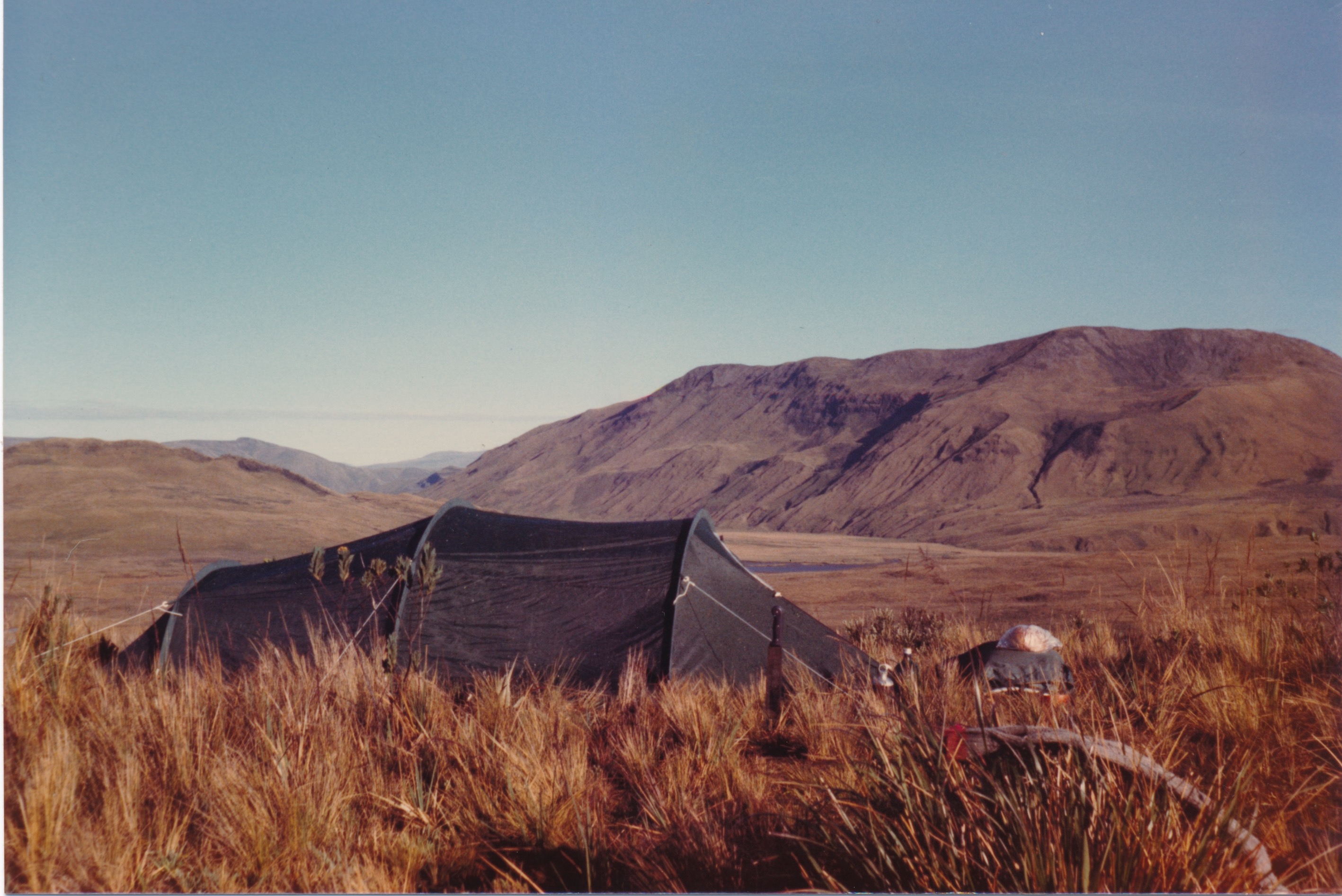
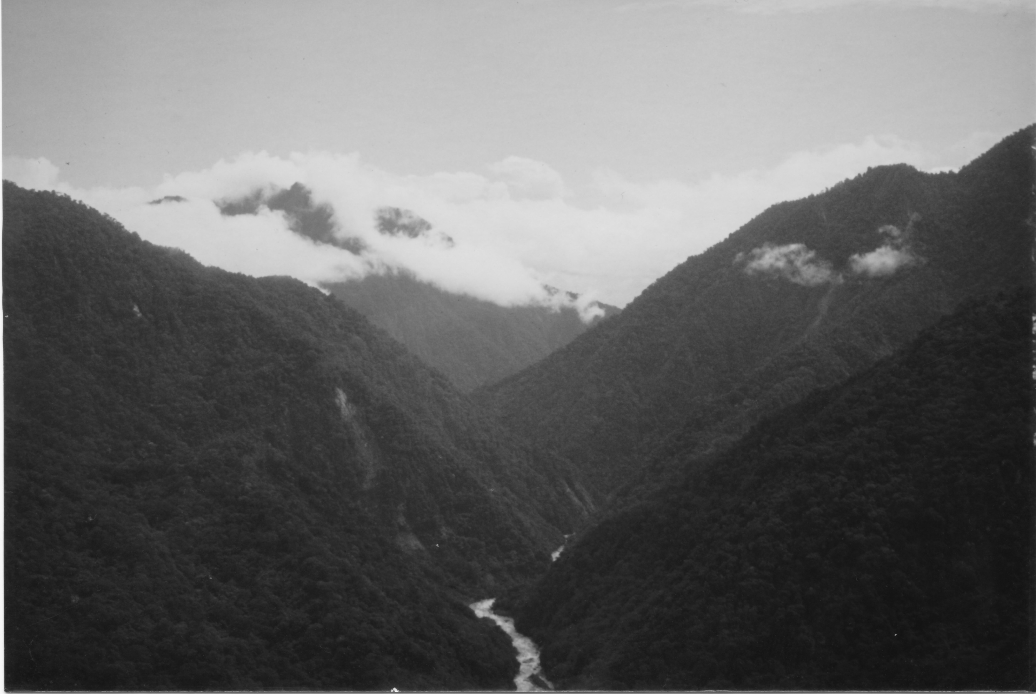
Thick and almost impenetrable cloud forest with little to no walking paths, wild cold rivers that plunge from the mountain heights, deep dark lakes, high freezing Paramo and rugged peaks.
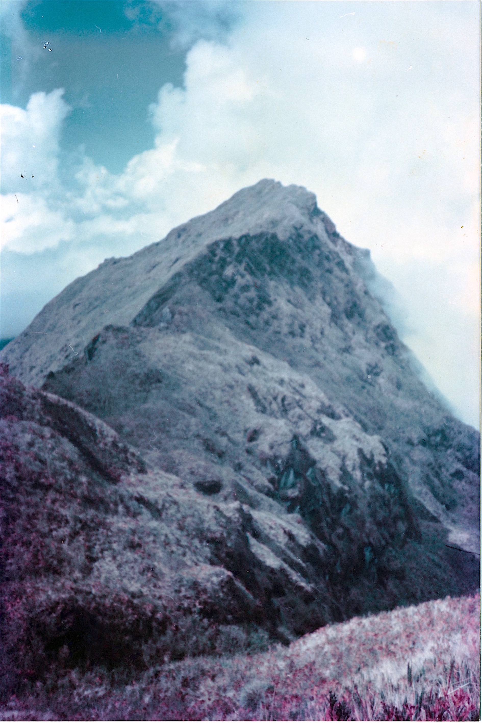
Ranging from 1500 meters up to 5000 meters of altitude on the snow-line this is the Llanganatis Mountains, home to Spectacle bears, puma, Tapir, Jaguars,the Andes white tail deer and the smaller Forest deer, amongst other animals.
Some would call it a cursed place, and anyone whom enters it will surely be tried, mentally spiritually and most certainly physically, and it is a tough place to find yourself.
What has brought successive explorers to these Mist covered Mountains for at least two centuries, is the historical story of Atahualpa’s Ransom, and the legend of Valverde’s gold.
Atahualpa was Cacique or Emporer of the Inca empire when Francis Pizarro invaded Peru in 1533. The story of his kidnapping and treacherous murder at Cajamarca, in what is now Northern Peru at the hands of Pizarro is historical fact. Having used his captivity to control the Inca empire and having had delivered by the Indians, enough gold to fill the now famous room at Cajamarca with golden artefacts. The spaniards decided that Atahualpa had outlived his usefulness and he was executed by the garrotte.
His general of the Northern armies, Ruminaui (stone face or stone eye) whom was born in the village of Pillaro in the Central Valley of the Quitonean Andes, of what today is now Ecuador, had been transporting a vast treasure to the South, to augment the ransom of his king Atahualpa when he heard of the killing of his cacique.
Ruminaui immediately changed his armies direction to the North, and as he was from the Village of Pillaro which is at the skirts of the Llanganatis Mountains, decided he would ensure that it would never be found by the gold obsessed Spanish, by hiding it on its wild slopes, In a lake made by hand, and deep into the mountains frigid interior.
Here the story would probably have ended as it was well known by the Spanish at the time that getting an Indian to talk when he was bound to silence would be unlikely. Despite extensive torture methods of which they were adept including, burning the poor wretches feet until their tendons snapped, the use of the garrotte, setting dogs on them which would often eat them alive, killing their families and many other generally antisocial activities they could not get the natives to divulge very much.
This is where the legend of Valverde comes into the story. It is hard to say when Valverde actually lived, it seems he was of the seventeenth century but it is not assured. What seems certain is he left behind a derretero or guide to the location of Ruminahuis hiding place for the treasure, for the express use of the King of Spain, whom sent his corregidores of the town of Latacunga to try and locate the lost fortune. How Valverde came into the possession of the hiding place of this treasure is not known. There is one story that he was a deserted soldier that had married an Indian girl of Pillaro, and that the locals of whom he was now family by blood ties, had shown him the location. The truth I think is not known, and it certainly isn’t written down in any historical documents that can be factually checked.
Valverde it is written had entered the Llanganatis many times, and carried off large amounts of the treasure before making his way back to Spain where he died, but not before dictating the famous guide to find the hiding place of the loot.
THE DERROTERO OR SENDERO
Spruce states in his book that he had secured and copied the guide, faithfully reproduced it along with a map by Don Antonio Guzman. The Originals of these documents can be found in his book, but here is an outline of the Guide or Derretero.
Valverde dictated the route to the Spanish Authorities in Spain, and as the guide itself explains, “He had entered the Llanganati many times and had carried off a great quantity of gold and that the king had commanded the corregidores of Tacunga (Now Latacunga) and Ambato to mount a search for the treasure”.
He goes on to say the guide and order are preserved in the offices of Tacunga, Today called Latacunga.
Valverde explains that first you must go the small town of Pillaro to the North east of Ambato, where “Placed in the town of Pillaro”
You were to ask for the farm of La Moya, and pass the night at the farm and in the morning ask to be shown the Cerro Guapa.
Here he tells you that if the weather is good you will be able to see the three cerros Llanganati.
“If the day be fine look to the east so that thy back be to the town of Ambato, and from thence though shall perceive the three cerros Llanganati in the form of a triangle”.
He goes on to explain that on their slopes there is a man made lake which the Indians had used to hide the treasure.
“On whose declavity there is a lake made by hand, into which the Ancients threw the gold they had prepared for the ransom of the Inca, when they heard of his death”
The guide goes on to explain that you should head for clump of arrow grass and Sangurimas a local bush with white foliage, these were to be seen in a small forest and you were to leave them on your left hand.
Then he led you across a wide morass which was some way ahead and beyond some cattle farms, having come through the morass you were to pass through a Jucal ( A tall solid stemmed grass) which was to be found on a hill side. Beyond the Jucal you would come across two small lakes called “Los Anteojos” or spectacles in English, due to their appearance of glasses, complete with a small hillside which stood between them and looks like a nose.
Here valverde gives another important clue, he stated that you “mayest again descry the Cerros Llanganati the same as thou sawest them from the top of Cerro Guapa”
After passing the night at a small plain in front of the nose which he called the sleeping place, he gave directions to continue.
“here though must leave thy horses because they can go no further, and Following on foot in the same direction thou shalt come upon a great black lake, which thy leave on the left hand”.
Beyond the lake you were to descend along the hill side in such a way as you would reach a ravine, and there you would find a waterfall and close by a bridge of three poles, or if that were not to exist then to throw another and cross the river.
Here having gone a little way into the forrest you were directed to spend the night in a hut or the remains of a hut which you were to find at this point.
“having passed the night there, go on thy way through the forest in the same direction, till thy reach another deep dry ravine”
Having reached the ravine as indicated you were then directed to “throw a bridge over it and pass over it slowly and cautiously for the ravine be very deep, that is if thy succeed not in finding the pass which exists”
From this point you are directed to go forward and look for the signs of another sleeping place which you were unlikely to miss, due to the pottery fragments left behind by the Indians, whom continuously pass along there.
Having passed the night at this campsite the guide directs you to “go on thy way and thou shalt see a mountain which is all of margasitas (pyrites) and thou shall leave said mountain on thy left hand”
Here Valverde warns you to go around the mountain in this fashion, here he makes a mysterious sign for you to follow around the mountain.

He goes on to explain that.
“On this side thy will find a pasture in a small plain, which having crossed though will find a canyon between two small hills which is the way of the Inca”
he directs you through the canyon with this enigmatic statement.
“From thence though shalt see the entrance to the socavon (tunnel) which is in the form of a church porch”
Having come through the canyon and continuing in the same direction you would then find a waterfall which descends into a quaking bog on your right hand.
“And without passing the stream in said bog there is much gold so that thrusting in thy hand all that thou gather are grains of gold”.
You are then directed to ascend the mountain by going to the right and passing above the cascade, going round the offshoot of the mountain, here you would find the tunnel.
“If by chance the mouth of the socavon be closed with certain herbs they call Salvaje, remove them and thou shalt find the entrance”.
On the left hand side of the mountain you were to see La Guayara, which he explained the ancients called a furnace where they smelted their metals, and that even in his time the name was only used to describe the the wind. he goes on to say it was nailed with golden nails or sprinkled with gold dependent on the translation.
From this point you were directed to “the third mountain”.
“And to reach the third mountain if though canst pass in front of the socavon it is the same thing to pass behind it, as the water of the lake falls into it”
The final note of the guide states.
If though lose thyself in the forest seek the river and follow it on thy right bank, lower down take to the beach and thy will reach the canyon in such sort that though thy seek to pass it though will not find where, climb therefore the mountain on your right hand, and in this manner, thy can by no means lose thy way”.
It is interesting to note that this document which was published along with extensive notes by Wallace in their Book: Notes of a botanist on the Amazon and the Andes, By Richard Spruce and Edited by Alfred Russel Wallace, was the only confirmed source of the guide and of the existence of this treasure, that is to say there seems not to be any other documented historical Archives. Published along with the Derrotero is also the famous Guzman Map the existence of which seems also to have come from Spruces Records, he himself explaining he had found it only after exhaustive research whilst he was in Ecuador. The full document, Wallace’s notes along with a full reproduction of Guzman’s map and many details can be found in Spruces and Wallace’s book.
What is not in any doubt is the fact that many of the clues are still in existence today, exactly as they were described by Valverde so long ago. Searchers though seem to lose their way halfway through the guide and there remains great controversy as to what features fits the description best beyond the valley with the waterfall, some distance after the great black lake.
It is certainly an interesting story, so interesting in fact that back in 1984 having read a book, Beyond the Ranges: by Hamish Mc Innes, I became hooked on the idea of having a look at the area myself.
Mc Innes is a Famous Scottish mountaineer, explorer and whom established the Glencoe Mountain rescue team in Scotland, and has led a pretty adventurous life. You can find out more about the man by visiting his website at: http://www.hamishmacinnes.com
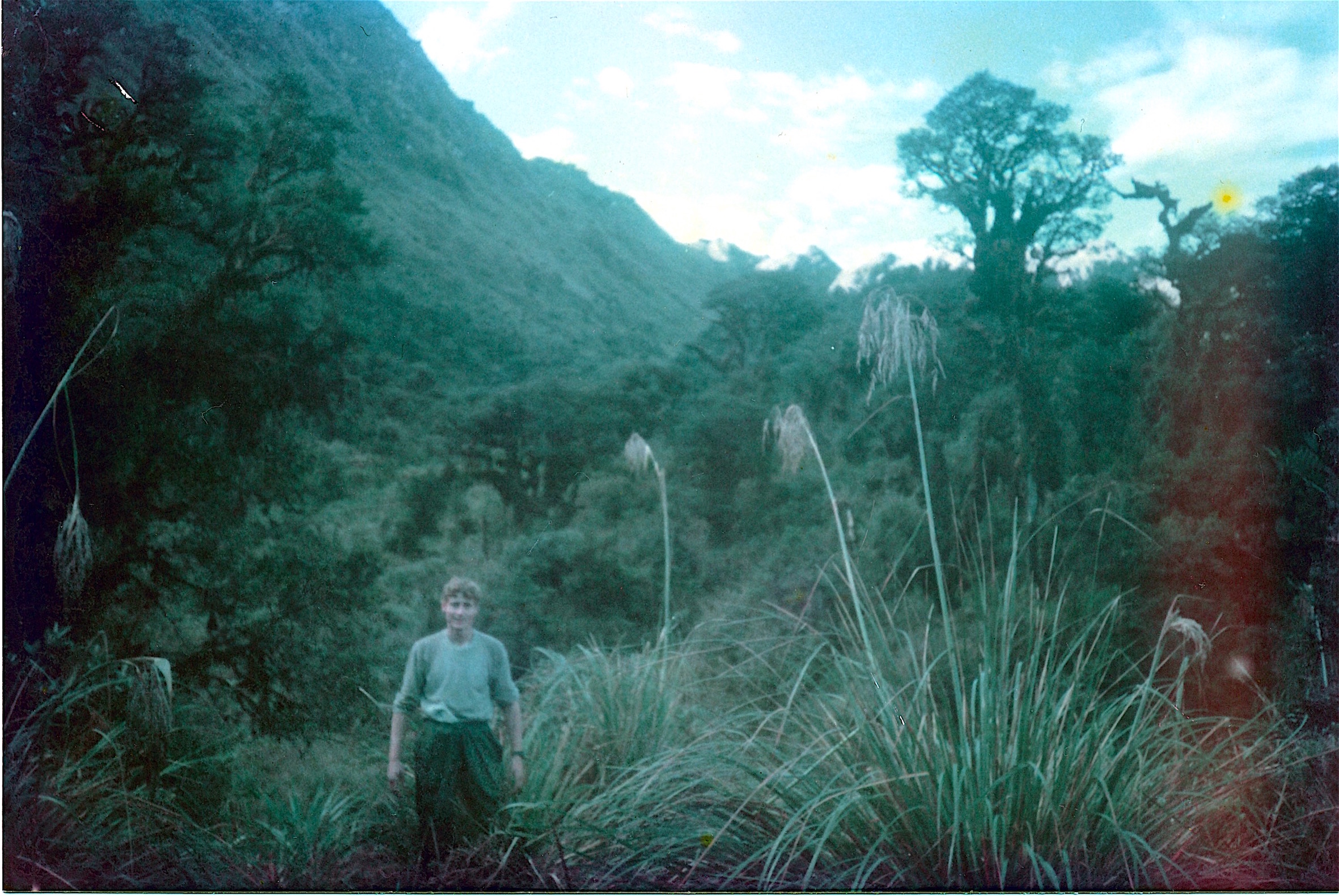
The upshot of all of this was I was able to find my way to Ecuador in late1985, as at that stage, I had five months free as I was just beginning my commercial diving career, it meant that I only had work during the summer months in the North Sea. On making my way to the country, one thing led to another, this led on to some of the best years of my life and certainly some of the most intense exploration I have ever done.
The adventure which covered numerous expeditions to the mountains, the tragic loss of life of a fellow diver, cave exploration, the excavation of a pre Colombian mine and many other exploits will I hope be covered in a forthcoming book.